Logbook: South Indian Ocean - Indonesia, Cocos Keeling, Rodrigues, Mauritius, Réunion, and Madagascar (April to October 2018)
When we left Port Dickson, Malaysia, in April 2018 we had a big year ahead of us. If all went as planned, we would be sailing over 6,000 nautical miles in the next six months, stopping at some remote islands in the Southern Indian Ocean, then making our way to Madagascar and finally reaching our destination of Richards Bay, South Africa. The Indian Ocean lived up to our expectation as the roughest ocean on which we would ever sail, and we faced a few challenges along the way, but overall our passages went as well as one could hope, and the places we visited were awesome!
Our route across the Indian OceanPort Dickson, Malaysia to the Sunda Straits (April 28 to May 4)
The first leg of our journey was a motor trip south from Port Dickson in Malaysia, crossing the Malacca Straits into Indonesia, then traveling along the east coast of Sumatra to the Sunda Straits, which is located between the islands of Java and Sumatra, a total distance of about 650 miles (1,046 km). The Sunda Straits would be our gateway to the Indian Ocean.
The area in Indonesia through which we would be traveling is commonly referred to as the doldrums because it is near the equator, and winds are generally light to non-existent, so we expected there would be little, if any, opportunity to sail. On the bright side, for much of this trip the island of Sumatra would provide protection from any Indian Ocean swell, so we could expect mostly flat seas. Since we didn't want to arrive at the Sunda Straits with an empty fuel tank and nowhere to buy more, we left with a full fuel tank (168 gallons / 636 liters), and carried an additional 95 gallons (360 liters) of diesel on deck in jerry jugs (twelve 30-liter jugs). Slip Away's stern was sitting quite low in the water!
Spare fuel on the back deck
Busy shipping lanes in the Malacca StraitsWe left Admiral Marina in Port Dickson late in the day on April 28, motored overnight, and stopped the next afternoon at Pulau Pisang, a small island with a good anchorage near the border of Malaysia and Singapore. We anchored for the night, and early the next morning we continued on our way, first crossing the very busy shipping lanes of the Malacca Straits and then entering the Durian Straits, timing the tide so that we would be traveling with a positive current. This was a great plan, but what we didn't count on was headwinds. As we entered the Durian Straits, we had about 10 knots of wind from the south (on the nose), which made for a bumpy wind-against-current ride. As the morning passed, we watched a big black cloud in front of us getting bigger and blacker. We didn't get a lot of rain, but the wind increased to 20 knots wind on the nose, which made for very short and steep waves in the channel, and we were bashing and burying our bow and making very slow progress.
We looked at our charts and saw Galam Harbour nearby and decided to duck in there until the winds subsided. There was nothing on the charts indicating that this was a big shipping harbor, but in fact it was, and there was even an Indonesian Navy Base here. As soon as we reached protected waters, we had a small launch coming at us with a young Naval officer aboard. The launch pulled up along side us, and the officer boarded Slip Away and asked our intentions. We showed him our port clearance paperwork from Malaysia indicating our intended destination of Australia (Cocos Keeling), and explained that we had just pulled into this harbor (actually a seaway between two islands) to get away from the rough seas. This young officer spoke some English but did not understand most of what we were trying to explain to him. He called his Commanding Officer and then told us we needed to bring Slip Away to their naval dock so his CO could determine our intentions. We respectfully refused to do this for many reasons, not the least of which was that we were within our rights to travel through Indonesia without checking in with their authorities as long as we did not go ashore. We had documentation stating this, and actually had an internet connection here so that we were able to access this information on-line in the Indonesian language (Bahasa) so that the young officer could understand. Long story short, we were detained for a couple of hours while several other Naval officers came out to us. We believe the first one to show up was an Intelligence Officer - he came with his camera, took photos of the outside of the boat, and then photos of the interior. (He was especially intrigued with Rich's stock of rum!) Once the Intelligence Officer was on board Slip Away, the younger officer departed, and the Intelligence Officer sat surveillance on board Slip Away until the Commanding Officer and a translator showed up. When the CO and translator arrived, we think the Intelligence Officer let him know everything was fine because the atmosphere became much more relaxed. The translator explained to us that they have problems with drug trafficking through this area, so it was necessary for them to make sure that we were not a part of that. At this point, everyone was all smiles, but even prior to this the officers were always very cordial to us - they were never rude or threatening, although the first launch driver needed some training because he put a gash in our hull! The CO gave us his phone number and told us to call if we had any trouble as we traveled to the Sunda Straits. They also asked if we wanted to come ashore and have dinner with them, which we politely refused. And, as is very typical of Indonesia, everyone wanted to have their picture taken with us!
The surveillance officer took this photo of us with
the Commanding Officer and the translator
Unsettled weather along our route
We breathed a huge sigh of relief when they finally let us go, but we lost 2½ hours of time. It was 4:30 p.m. and we had a problem. We did not have enough time before sundown to get away from the narrow straits where the local fishing fleets ply the waters at night with nets and long lines. We looked at the charts and found a small island (Morolaut, coordinates 00 46.57N, 103 39.71E) where it looked like we could anchor for the night. We dropped our hook at 8:30 p.m., a very nerve-wracking 90 minutes after sunset, but the moon provided decent light, as we dodged a few fishing floats on our way to the anchorage. This little island proved to be a nice calm anchorage, and we got a good night's sleep before continuing on at first light the next morning.
The rest of the trip to the Sunda Straits went without incident, and we traveled non-stop for the next 3½ days. We transited the Durian Straits, crossed the equator for the third time on board Slip Away, and then transited the Berhala and Bangka Straits before finally reaching the Sunda Straits. Once south of the Durian Straits, we saw limited fishing activity at night, perhaps because of the shipping traffic in the Berhala and Bangka Straits. The shipping traffic required us to be on high alert during our night watches, but it also provided the shot of adrenalin needed to do so. Night watch in the Bangka Straits was especially challenging because there was so much tug-and-tow traffic, and not all of them had AIS, but radar and a full moon helped us out there. We had agreed that we would stop and anchor if we felt it was too risky to travel at night (the depths were such that we could have easily pulled off to the side of the straits to anchor), but neither of us felt the situation was unmanageable.
Slip Away and crew's third equator crossing
Our route through Indonesia to the Sunda Straits
Fishing platform along the coast of Sumatra just before
reaching the Sunda Straits - wouldn't want to run into that at night!We approached the Sunda Straits with some apprehension because we'd heard stories from others that there are ships and ferries coming and going in every direction with no real traffic pattern. Maybe it was just good timing, but for us there was no drama. We stayed close to the Sumatra side of the channel and saw only a couple of big ships near us. We had to deal with some ferry traffic because they run back and forth across the channel between Java and Sumatra, but it wasn't a big deal. We transited the Sunda Straits at noon, and had 44 miles to go to reach Rakata Kecil (Little Krakatoa), our intended anchorage for the night. We would be arriving at the anchorage just after dark, but there wasn't another one closer. We had a waypoint from friends who had stayed in this anchorage previously, and from the charts, the approach looked easy and straightforward.
The sun was setting as we were a few miles from the anchorage, and since we were just past a full moon, once the sun dropped, darkness descended quickly. The darkness was exacerbated by an approaching squall with lightning and thunder. As we neared the anchorage in pitch blackness, with howling winds, lightning and thunder, we saw a line of fishing boat lights in front of the anchorage - our stress levels were soaring right about now! But we somehow managed to weave our way through the fishing boats, and drop our anchor seconds before the rain started pouring down. Relief! After dumping some rain on us, the squall passed and all was calm. We drank a beer, ate some dinner and crashed. We woke the next morning to the sight a smoking Krakatoa volcano off our starboard beam. Wow!
Rakata Kecil / Little Krakatoa Anchorage, Indonesia (May 4 to 7)
We spent three nights at the Little Krakatoa anchorage, watching the weather and prepping for the next leg of our journey, another 600+ mile passage, but this one offshore to the Cocos Keeling Islands, owned by Australia. Jan prepared passage food - one pot meals which could easily be reheated on our stove. Rich used a 12-volt pump which he built to transfer the diesel from the jerry jugs into our main fuel tank, and we then flagged down a local fishing boat and gave them six of our empty jugs. They were grateful to have them, and we were happy to be rid of them. They offered us some fish in exchange for the jugs, but we politely declined. The fishing stocks in SE Asia are seriously depleted, so we preferred to just give them the jugs as a gift. We kept six jugs because we figured we might need them in the next few months. We charted our course to Cocos Keeling and watched the weather. We also took some breaks and swam around the boat a bit to cool off. The weather is hot at the equator!
The majority of boats which transit the Indian Ocean travel via a northern route (via Sri Lanka, Maldives, Chagos and Madagascar), but the stops along the "southern route" appealed more to us. We were aware of and in touch with two other boats who were also planning to travel the southern route. Stefan & Sue (s.v. Charlotte) were a few days ahead of us, and already well on their way to Cocos Keeling, so we would meet up with them there. Peter & Donna (s.v. Kokomo) motored all the way down to the Sunda Straits, arriving a couple days before us, but then found a problem with their boat which could not be ignored, and had to turn around and motor all the way back to Malaysia for haul-out and repair - so incredibly disappointing!
Krakatoa with a local fishing boat anchored nearby
Transferring diesel from the jerry jugs to the
main fuel tank with the pump built by Rich
Passage from Krakatoa, Indonesia, to Cocos Keeling Islands, Australia (May 7 to 12, 628 nautical miles, 4 days + 20 1/2 hours). This would be our first offshore passage in the Indian Ocean, and it had been quite a while since we had done any offshore sailing. Since the Indian Ocean has a reputation for being rough, we were a little nervous. We downloaded weather files, and they looked pretty reasonable, except that the winds and seas would be up near the end of the trip. Although we did not anticipate any problems dealing with 3+ meter seas, they didn't sound all that appealing, but we figured we probably needed to get used to having seas of that magnitude in the Indian Ocean.
We weighed anchor early afternoon on May 7 and motored through the channel separating Little Krakatoa and the main Krakatoa volcano. We had read a little bit of the history of Krakatoa, so were aware of the havoc this volcano wreaked after its major eruption in 1883. Little did we know that seven months after we plied these waters, Krakatoa would have another significant eruption (in December 2018), sending a tsunami along the shores of the Sunda Straits. Our guardian angels obviously had their eye on us!
Sailing past the smoking Krakatoa as we departed IndonesiaOverall the passage to Cocos Keeling went well, with a couple of exciting moments. Shortly after departing the anchorage, we had enough wind to set our sails, and we shut down the engine. By departing at noon, we were well away from the local fishing fleet by sunset, so relieved that we didn't have to worry about them. Our first couple days on passage were quite pleasant as we sailed on a broad reach with wind in the mid-teens and 1-2 meter seas. We never saw another fishing boat until we were over 300 miles offshore from Indonesia when we came across a large fishing fleet in the middle of the night. The fishing fleet was well lit to attract fish, but none of the boats were running AIS transponders. Rich was on watch, and using eyeball navigation he guided Slip Away through the fleet. He breathed a huge sigh of relief when we left them in our wake and hadn't gotten caught up in any nets or long lines. The following night was no less exciting compliments of Mother Nature. When we changed watch at midnight, even with no moon, we could still see that the skies behind us were very heavy, and we reefed down to deal with whatever might be coming. We felt like sitting ducks as the squalls marched through, one after another. Winds would increase from 12-15 to 25-30 knots, the rain would pour down, and then the winds and rain would abate. The cycle repeated every 20-30 minutes. We kept the sails reefed, so Slip Away moved slowly, but she handled it well. The squally weather lasted about 24 hours, and needless to say, we were very happy when it subsided. The next morning, shortly after sunrise, we arrived and anchored at Direction Island, Cocos Keeling.
Cocos Keeling Islands (May 12 to June 4) The Cocos Keeling Islands have been a territory of Australia since 1984 and are comprised of two coral atolls and 27 low-lying islands. The islands were discovered in 1609 by Captain William Keeling from the British East India Company. The smaller, more northerly atoll is an uninhabited National Park. The southerly atoll has three significant islands - Home, West and Direction Islands. Home and West Islands are presently the only inhabited islands in Cocos Keeling. Home Island has a population of approximately 500 people who are descendents of Malay copra plantation workers brought to the islands in the early 1800's. West Island has a population of approximately 120, primarily Australians who are part of the military and National Parks system. We anchored off Direction Island, which is uninhabited but has an interesting history. In the early 1900's, Direction Island served as a vital link in a chain of undersea telegraphic cables, and a cable station was established on the island. In 1914, during World War I, the German battleship SMS Emden attacked Direction Island, attempting to destroy the communications link, but the Royal Australian Navy's HMS Sydney defeated the Emden.
Shortly after dropping our anchor, the Australian authorities arrived by boat to complete check-in formalities. The check-in process was efficient and the officer was very friendly. He provided us a 5-page list of rules and regulations for visiting yachts (Australia is king of rules and regulations!), told us to enjoy our stay and said we could call if we needed anything. Although there was no cell service here, the police could be reached via VHF radio, and there was a land-line telephone on Direction Island that we could use free of charge to call businesses or individuals on Home and West Islands, as well as a directory by the telephone listing everyone's numbers.We were quite happy to be at Cocos Keeling. The sea and air temperatures were very pleasant (a relief from the heat and humidity of SE Asia), the water in the anchorage was an incredible blue, and stunning white sand beaches fringed Direction Island. Sue & Stefan (s.v. Charlotte) were in the anchorage when we arrived, so it was nice to catch up with them, and we also met Lionel & Nathalie (s.v. Rokalo), a French couple who arrived on the same morning as us.
Australian authorities arriving at Slip Away to clear us inOur tentative plan was to spend a couple of weeks in Cocos Keeling and chill out a bit. It was such a joy to swim in the clear blue water of the anchorage and snorkel on the numerous coral heads, as well as in "The Rip", which is a drift dive where big fish congregate in the pass between Direction and Home Islands. The corals at Cocos Keeling were healthy, fish life was good, and we saw a number of green turtles, which nest on the northern atoll. Direction Island was quite flat and not very big - about 1 km long by ½ km wide - but it has a "Heritage Trail" on it with signboards depicting some of the history of the islands. The trail meandered through groves of coconut palms, and we walked across and back and from end to end numerous times just trying to maintain some muscle tone in our legs. Cocos Keeling gets a few tourists (but very few), and the tour operators bring guests to Direction Island. There is a shelter and picnic tables for the tourists on Direction Island, and water from the roof of the shelter is funneled into a big tank. We were able to use that water for laundry which was a nice convenience. Since the tourists were only at the island one or two days a week, we had Direction Island mostly to ourselves.
We could dinghy to Home Island (2 miles one-way) and did so a few times, and twice, we caught the ferry from Home Island to West Island (too far to go in our dinghy). All of the islands are flat and sandy, and there wasn't really much to see on them, but both Home and West Islands had internet access, which was expensive and slow. (There is normally a wifi signal broadcast from Direction Island, but it was not working during our visit, and the guy who needed to fix it was off island.) There were some small grocery stores on both Home and West Islands, also very expensive, but ice cream bars were affordable. We ate lunch at the Tropika restaurant on West Island (OK burgers and fish sandwiches), but the restaurant on Home Island was closed because it was Ramadan, and the Muslims fast from dawn to dusk during that time.
The beach on Direction Island was stunning!
We enjoyed learning about Direction Island's interesting
history on the Heritage Trail walk
Such beautiful clear water for snorkeling!
West Island - home to a very small population of AussiesDuring our stay at Cocos Keeling, we were keeping a watchful eye on the weather. Our next passage would be a long one - 2000 nautical miles, which would take about two weeks - to the island of Rodrigues, and we expected it would be one of the most challenging of our passages for the season. It's impossible to accurately forecast the weather two weeks out, so one needs to just take their best guess and go for it. We know of boats which had good passages from Cocos Keeling to Rodrigues, and others which had it pretty rough. Sue & Stefan (s.v. Charlotte) departed for Rodrigues a few days after we arrived in Cocos Keeling, and we kept in touch with them via the SSB radio to monitor their progress and conditions. The first part of their trip went well, but then they had a few very rough days with winds gusting into the mid-40's (50+ mph) and 5-6 meter seas toward the end of it. We've never sailed in conditions like that, and had no desire to do so, but we knew that we needed to be both mentally and physically prepared. Lionel & Nathalie (s.v. Rokalo) left a few days after Sue & Stefan, and another French boat came and went. We kept looking at the weather and thinking it looked rougher than we would prefer. By the end of our second week in Cocos Keeling, the weather was quite unsettled, with numerous squalls and winds up to 35 knots in our anchorage, and so we waited. After the big winds came and went, the forecast showed no wind for the first several days of the passage, and since we didn't want to burn through our supply of diesel on the first part of the passage, we continued to wait. All this weather stuff was playing mind games with us, and we grew incredibly anxious!
During the period of calm, we had a couple of new arrivals in the anchorage - David & Agnes (s.v. Gostoza Tu from Memphis, Tennessee), and Brian, Carol & Matt (s.v. Prince Diamond from Toronto, Canada). Since Rich would be celebrating his 70th birthday on our passage to Rodrigues, Jan organized an afternoon barbeque and birthday party for him on Direction Island with the crews of Gostoza Tu and Prince Diamond. Good fun!
Celebrating Rich's birthday with the crews of Prince Diamond and
Gostoza Tu. Agnes (Gostoza Tu) took the photo, and her husband
David is on the phone with an engine mechanic on West Island.
Sailors who stop at Cocos Keeling hang plaques or other signs on the
shelter at Direction Island. We hung ours near Chantey and Flour Girl,
friends who stopped here two years before us.After three weeks at Cocos Keeling, we saw what looked to be a reasonable weather window for the passage to Rodrigues. Although we enjoyed our time at Cocos Keeling, we were quite ready to move on. We'd snorkeled the reefs several times, walked the trails on Direction Island almost daily, and saw the few sights there were to see on Home and West islands. We were pretty much out of fresh produce (only a couple of carrots and some cabbage left), and since fruits and veggies were crazy expensive here ($12 AUD for a head of iceberg lettuce!), we bought very little and instead chose to eat from our stock of canned goods. Also, our trash was piling up because no trash disposal facilities were available to us here, and burning paper trash on Direction Island and throwing fruit and veggie scraps overboard were forbidden. There were recycling bins for metal cans, glass and plastics on both Home and West Island, but we were not allowed to use them. In essence, the Australian Government was telling us to take our trash elsewhere, which for most cruising boats means Rodrigues Island, a more remote island with less infrastructure. Australia charges $50 AUD per week to anchor at Cocos Keeling, which is quite expensive for an anchorage, and especially one which offers such limited services.
Passage from Cocos Keeling to Rodrigues Island (June 4 to 18, 2000 nautical miles, 14 days + 10 hours). Departure from Cocos Keeling required that we motor north out of Port Refuge and then turn northwest to round Horsburgh Island before setting our west-southwest course toward Rodrigues. Winds were blowing 15-20 knots from the northwest when we left Direction Island, so we bashed into 1.5 meter (5 foot) seas for about 45 minutes until we rounded Horsburgh Island. For the most part, this entire passage was pretty rough and uncomfortable, but we expected that, and felt very fortunate to have avoided any severe weather. The highest winds we saw were in the upper 20's, which are quite acceptable, and for almost the entire passage, the wind was usually just aft of the beam, so the sail plan was easily manageable - port tack with double reefed main and genoa on starboard side. The seas were generally about 2 to 3 meters (6 to 10 feet), and especially at the start we had a cross-swell, which made them rough and confused (and made the crew a bit grumpy!). The roughest day was Rich's birthday (June 7), and late that afternoon, Jan was below working in the galley and Rich was in the cockpit when a big wave slammed into the port side of the boat. What a horrible sound!! The wave did no damage to the boat; however, despite having our cockpit enclosure secured in place, about 5 gallons (20 liters) of water streamed into the cockpit, completely dousing Rich. Not a great birthday present! During most of the trip, we often had splashes of seawater in the cockpit - never any major waves flooding it, but our normally dry cockpit was rather soggy. Many of the entries in our logbook on this passage say "Rough!", and we had a number of squalls along the way, but again, nothing severe. On our last night at sea (about 14 hours out of Rodrigues), the winds backed, which meant that in order to continue sailing efficiently, Rich would need to go out on deck to set the pole on the headsail to sail wing-and-wing. Seas were rough, it was 2 a.m., and neither of us wanted Rich to go out on deck. We had plenty of fuel, so we furled the headsail and motor-sailed the rest of the way to Rodrigues, arriving at the channel to Port Mathurin in the early afternoon. Slip Away was covered in salt, but all was well and we made it!! This passage which had caused us so much angst was over and done with!!
Big seas on Rich's birthday
Rich's method of tying himself to his seat so
he did not get thrown across the cockpit,
and getting a bit bristly after 14 days at sea
More rough seas - Ugh!Rodrigues Island (June 18 to July 20)
Rodrigues Island is part of the Mascarene Archipelago, a small group of islands which also includes Mauritius and Réunion. Rodrigues is an autonomous outer island of the small Republic of Mauritius, located in the Southern Indian Ocean. It was discovered and named by the Portuguese explorer, Diego Rodriguez in 1528. It was originally settled and colonized by the French, but then ruled by the British from 1809 until Mauritius gained independence in 1968. Although ruled by the British for over 150 years, French influence remains on the island, including the pronunciation of its name - "Rod Reeg." Most of the inhabitants are Creole - mixed African and European descent - and the population here numbers just over 40,000. The capital of the island is Port Mathurin, and all cruising yachts are required to check in and complete formalities with officials at that location. Port Mathurin is essentially the only safe harbor for cruising yachts - a couple of smaller anchorages on the other side of the island are difficult to enter and don't offer good protection from the trade winds. The island is surrounded by reefs, but Port Mathurin has a well-marked, dredged channel and has a commercial wharf which is visited by a supply ship every week to 10 days. Cruising yachts are allowed to tie up to the wharf for free when there is not a supply ship in port, or they can anchor in the turning basin off the wharf. When the supply ship came in, all cruising yachts were required to vacate the wharf and turning basin while the supply ship docked or undocked. During that exercise, the yachts moved to a temporary anchorage just outside the dredged channel.
Charlotte in the outer anchorage as the supply ship Anna arrives
View of the dredged turning basin / anchorage at Rodrigues with the ferry
Mauritius Trochetia at the wharf. The ferry came in once during our stay here.Upon arrival at Port Mathurin, cruising yachts are encouraged to tie up to the commercial wharf to complete check-in formalities, but it was full when we arrived, so we anchored. The wharf is a concrete wall with big tires and other black rubber fenders on it. We were not particularly enthused with the idea of tying up there, so we were quite happy to anchor. Charlotte was the only other boat in the anchorage when we arrived, so there was plenty of room for us. A week prior to our arrival, there were a dozen boats (most of whom had arrived from the Chagos archipelago) in the anchorage, and space was pretty tight at that time, but they had moved on.
We arrived mid-afternoon, and shortly after we dropped our hook, the port police came out to Slip Away in their launch and brought the health and quarantine officer with them. We filled out some paperwork for them, and they asked us to come ashore as soon as possible to complete our check-in with Customs and Immigration. It was mid-afternoon, and we were pretty knackered after our passage and asked if we could complete our check-in in the morning, but they insisted that we come ashore that afternoon. At that point, we should have asked the Port Police for a ride to shore - they were a couple of young guys who were very eager to provide assistance - but we were not thinking clearly. We let them go and set about launching our dinghy. Normally, launching the dinghy from the davits on the stern of Slip Away is a fairly simple operation, but we had deflated and stowed the dinghy on the bow for this passage because we were concerned about the possibility of a big wave ripping the dinghy off the stern. So, we unlashed the dinghy, cleared out the dead squid and flying fish which had accumulated on our passage, pumped it up, launched it over the side, put the fuel tank and seat in place, and were about to put the outboard on it when we looked at the sky and saw very large threatening black clouds approaching. We called the Port Police and explained to them that we felt it wouldn't be prudent to leave our boat at anchor with a storm threatening. A few minutes later, they called us back and said they would bring the Immigration Officer out to us. By the time they arrived at Slip Away with the Immigration Officer, it was almost dark and bucketing down rain. The Immigration Officer was a beautiful and sweet young woman, and the young police officers obviously adored her. They had her wrapped in a rain jacket and helped her aboard Slip Away. She had never been on a sailboat before, so while Rich filled out paperwork, Jan showed her around the boat. She needed to take our passports ashore to her office to stamp them and record some information, and when she completed that task, the police officers brought them back out to us - still in the pouring rain. We thanked them with a couple of cold beers. These young officers were really delightful. The big rainstorm on the evening we arrived was perfect because it washed the accumulated salt off Slip Away. We sat in our cockpit in the pouring rain, celebrated our arrival with a couple of beers and slept like the dead that night. The next morning, we went ashore and found the Customs Officer to finish our check in - this small island sure required a lot of paperwork! When we were finished with that, a local man named Harry introduced himself to us and offered to take us to lunch and show us around town. Harry is a tug-boat captain and a sort of self-appointed ambassador. He loves meeting the sailors who visit Rodrigues and makes it a point to welcome each and every one to the island. Rodrigues is known among sailors as the friendliest island in the Indian Ocean, a reputation which is well deserved.
Rich & Harry, the tugboat captainVisiting Rodrigues is like taking a step back in time to a small rural island with a laid back atmosphere. The island boasts a number of hiking trails, a good fresh produce market and a bakery with fresh baguettes daily. For us, it was the perfect place to hang out for a while, and we stayed for a month. During our first week on the island, we had opportunities to socialize with some of the other sailors who were here, but after that, most of them had moved on. A few other boats came and went during our time here, but s.v. Charlotte was the only other boat that lingered as long as us, and we really enjoyed spending time with Sue & Stefan. Water temps were too chilly for snorkeling (at least for us), but air temps were quite pleasant for hiking, and the crews of Charlotte and Slip Away did several hikes together. There were a number of good walks near the port, and when we wanted to go further afield, we could catch a bus - public transportation was fairly easy and cheap. The hiking trails were not always obvious or well-marked, but between Stefan's good eye for spray-painted patches on rocks or trees, and the Maps.me app on Jan's phone, we managed to find our way. Most of these trails were not developed as hiking trails for tourists, but were trails that locals used to get from place to place. We sometimes found ourselves walking through locals' backyards, but folks always smiled and waved to us. The island of Rodrigues is not extremely high, but it is hilly, and a few of the trails and local streets were pretty steep. Our legs were a little sore at first, but after a month of hiking on the island, we were feeling pretty good! Often after a hike, the crews of Slip Away and Charlotte stopped for an ice cream at the Point Chaud cafe, and we enjoyed meeting the French expats Georges and Nathalie who owned it. In addition to the hikes, we spent a day visiting the François Leguat Tortoise Park, where they are making great efforts to preserve their native tortoise populations. Life was quite good here, but of course the day came when we needed to move on.
Local music and dance performance at the Marouk Ebony Hotel
We asked this young man Jefferson for directions,
and he walked us to our destination.
Goats were a common sight during our walks on Rodrigues.
Lunch with a view with Sue & Stefan (s.v. Charlotte)
Mt. Croupier was only 50 meters (164 feet) high, but the scenery was beautiful
The tortoises at François Leguat Park begged us to pet them!
One of our daily trips to the boulangerie
for a fresh baked baguette
Full moon setting on RodriguesAs friendly and helpful as the folks were in Rodrigues, the officials were sticklers about a few rules, which made life a little more difficult than necessary for the sailing community. When we were ready to move on to our next port, once we completed our departure paperwork, we were required to leave Port Mathurin within an hour. Given the distance between Rodrigues and our next port of call - Port Louis on Mauritius - the ideal time to depart was at first light, so that one could arrive at Port Louis just before dark two days later. Leaving any later than first light essentially guaranteed an arrival at Port Louis in the dark. Also, the officials did not work on weekends, so if the perfect weather window appeared on a Saturday or Sunday, that was too bad. Yachties have been lobbying the government officials for a change to these rules for years, but things are slow to change on islands like Rodrigues. (Most other countries give yachts 24-48 hours to depart after clearance paperwork is completed.)
Passage to Port Louis, Mauritius (July 20 to 23, 350 nautical miles, 2 days + 13 hours). As we watched for a weather window to sail to Mauritius, we found ones with either more wind than we preferred or no wind at all. We didn't really want to motor the 350 miles to Mauritius, so we finally settled on one that had fairly strong winds on our first day out, but settling down on day two. The crew of s.v. Charlotte was planning their departure at the same time as us, and our boats were pretty well matched in terms of speed, so it was nice to know that we would have company on this trip. We completed our departure paperwork on a Friday morning, and departed Port Mathurin at 10:30 a.m. As expected, winds and seas were up - it was blowing 25-30 knots, and seas were about 4 meters. Our first day was fast with our speed over ground mostly in the high 6's, and Charlotte was close by. Our first night at sea was very rough - lots of squalls, wind shifts and variance in wind speed. As a squall would approach, the wind would gust up into the low 30's, then it would rain and blow 25-30 knots for 30 minutes or so, and then the wind would completely die. After another 20 minutes or so, winds would normalize at about 20 knots, but then shortly thereafter the squall cycle would start again. This went on pretty much all night and was not fun! We furled our headsail and sailed with a double-reefed main only. In all of the miles we've sailed, this was the most challenging night ever for our autopilot. We had a number of "off course" alarms when the initial gusts of the squall hit us, and the on-watch person would need to steer us back on course and re-set, but overall, we were quite pleased with how well it handled these conditions.
Conditions settled down the next day and were quite pleasant. The squalls went away, winds settled out at about 20 knots, and although the seas were still about 4 meters, the period between the swells was long enough to be reasonably comfortable. On our second night at sea, we had mostly clear skies and only one very minor squall. What a difference! If we had been able to leave Rodrigues on a Saturday instead of Friday, this would have been our first night at sea, and we could have avoided that first night from hell!
On Sunday afternoon, we were approaching the north end of Mauritius, trying to time our passage over the top of the island to coincide with slack tide to avoid rough wind-against-current conditions. Winds were supposed abate, but instead they were back up to 25-30 knots, and we were arriving too early. After much discussion, we decided to take down the main and continue with just our headsail because we felt we could control our speed better that way. This decision was not easily made because it required that Rich would go out on deck to secure the main, while Jan steered Slip Away into the strong winds and 4 meter seas. We successfully completed that maneuver, and continued on with just the headsail, which slowed us down nicely to arrive at slack tide, although we still had a few hours to go to the north end of the island. We were patting ourselves on the back for about 90 minutes, but then the winds dropped to 12-15 knots. Grrr!!! Our headsail was flogging around with little wind and big seas. Rather than go through the exercise of changing our sail configuration again, which would require another trip on deck for Rich, we started the engine. We were frustrated and rationalized that it was just not worth it to risk an injury - buying more fuel was a much better option! We arrived at the north end of Mauritius at slack tide as planned and as the last traces of daylight were fading. We rounded the top, and as we turned the corner and motored south along the west coast, we had pleasant and calm conditions with the island blocking the wind and seas. Friends on s.v. Brick House had given us a waypoint for a spot along the coast where they had anchored for the night - an open roadstead which was easily approachable in the dark. We dropped our hook just before midnight, and s.v. Charlotte pulled in just behind us. We celebrated our arrival with a beer, enjoying this peaceful and tranquil spot for a short while before heading to bed. We weighed anchor the next morning at 0900 and motored the last few miles to Port Louis, where we would check in.
Port Louis, Mauritius (July 23 to August 6). Port Louis and the main island of Mauritius had a much different feel from the smaller outer island of Rodrigues. For starters, British influence was much stronger here, and the population was quite different too. While under British rule, Indians were brought to Mauritius as indentured servants to work on sugar cane plantations. The total population of Mauritius is approximately 1.2 million, and about 2/3 of that population is of Indian descent, while only about 1/4 were Creole (which was the vast majority on Rodrigues). The capital city of Port Louis is modern and busy, and the island has vacation resorts (two Club Meds), shopping malls and highways. Cruising yachts are required to check in at Port Louis, and although there is not an option for anchoring near Port Louis, one can stay at Le Caudan Marina, which is part of a modern waterfront development with hotels and restaurants. There are only a couple of anchoring options on Mauritius - one at Grand Baie on the north end of the island and another toward the south end of the island at Riviere Noire. We opted to stay at the Le Caudan Marina because we liked the central location and ease of access to shore amenities. In addition to the waterfront development area, the marina was walking distance to the downtown area with additional restaurants and shops, bus terminals at the north and south ends of the city, and the fresh produce market, which offered an outstanding variety of fruits and veggies. One thing about this marina that was a bit unusual (at least to us) was that it had no docks. Instead, it was a u-shaped basin with concrete walls and bollards to which we tied up. The tidal range was not huge, but it was significant enough that our fenders got quite a workout on the concrete wall. On one of our last trips back to the U.S., we had purchased three very large Megafend inflatable fenders (normally very expensive, but Jan found some pre-owned but never used on eBay), and they were a god-send in this situation.
Slip Away at Le Caudan MarinaThe bus stations in Port Louis were convenient, and offered good transportation to other parts of the island. We took the bus north to Grand Baie one day to meet up with Sue & Stefan (s.v. Charlotte) who were anchored there. Grand Baie is a touristy beach town but was nice for a day visit. Locals recommended that we also take a bus to Bagatelle Mall - the Mauritians are very proud of their shopping malls. Although shopping malls are not great attractions for us, this one did have a couple of very nice grocery stores, and the highlight of that day was lunch at the Flying Dodo Brewing Company (good local beers!). We researched hiking trails and found one that interested both us and the crew of s.v. Charlotte - Le Pouce, aka the Thumb. We bussed to the starting point of the hike, and hiked to a peak overlooking Port Louis, then walked back to town - a great day out! We spent another day on a driving tour of the southern part of the island. We shared the day with Mike & Jennifer (s.v. Mahili), and hired a taxi driver named Ehsan who took us to all the big tourist attractions on the island - a drive through the town of Curepipe, the Grand Bassin (a crater lake and the most sacred Hindu place on the island), Chamarel Falls and Coloured Earth, Black River Gorge and the Riviere Noir. Another outing which was really quite fun was a trip to the Champs de Mars horse racing track on the outskirts of Port Louis. Champs de Mars is the oldest thoroughbred horse racing track in the Southern Hemisphere, and the horses ran every Saturday from March through November. Another cruising yacht had provided contact information for a gentleman named Lalah at the race track, and through him, we were able to purchase entrance to a private grandstand area that was less crowded than the general admission area. (A day at the races is very popular in Mauritius, and the general admission area was a madhouse!) David & Agnes (s.v. Gostoza Tu) and Jens & Dorthe (s.v. Kigdlua from Greenland) joined us, and we had a really fun time. Jan was the big winner that day - winning every race but two. Her strategy: Bet on horse #3!
Excellent fruit & veggie selection at the fresh market in Port Louis
Statue of Queen Elizabeth - a remnant of the colonial days
Horseracing at Champs de Mars
Up until this point, the hike to Le Pouce was pretty easy
We were rewarded by this incredible view after the steep climb up Le Pouce
Sainte Thérèse Church in Curepipe
Grand Bassin
Chamarel FallsAlso while in Port Louis, Rich made yet another stop on his "Healthcare in Exotic Locations" tour. He had decided to install an additional shut-off valve on our watermaker system and had a previously used valve on board that would do the job. The valve had a bit of hard barnacle-like stuff encrusted on the inside, so he was cleaning it up before installing it. As he scraped it out, he managed to flick a piece of crusty-stuff in his eye - this, despite the fact that he was wearing glasses. When he blinked, it felt like sandpaper scraping on his eye. We flushed his eye with water, but that provided no relief. We called the marina manager who recommended that we go to the City Clinic. We taxied to the City Clinic, and they too tried to flush it out with no success. They then administered some drops to numb his eye and called their staff ophthalmologist. The doctor drove an hour to the clinic (on a Saturday) to attend to Rich. It took the doctor a matter of minutes to find and remove the offending piece of grit which was embedded on the inside of Rich's upper eyelid. The doctor sent Rich home with some antibiotic eye drops, and he had no further problems with it. Never a dull moment, and once again, we found excellent healthcare services overseas.
It was a busy two weeks in Mauritius and we enjoyed our time here, but we were eager to move on to our next stop at Réunion Island.
Passage from Mauritius to Réunion Island (August 6 to 7, 135 miles, 25 hours). We intended to leave Port Louis on a Monday morning, and were hoping to shove off at about 10 a.m. since the trip to Réunion would take us a little over 24 hours. We made arrangements with the Customs & Immigration officials to complete our clearance paperwork at the Customs Dock near the marina first thing on Monday morning. The Immigration Officer showed up promptly at 8:30 a.m., but Customs made our life difficult. They did not show up as agreed, and we both waited patiently for a while, but then Rich headed back to Slip Away to complete some preparations. Jan waited a bit longer, but then the Customs officer decided he was not coming, and told her she needed to come to the main Customs office. The main Customs office was too far to walk in a reasonable amount of time, so she needed to take a taxi. This normally would not be a problem, but we had spent almost all of our Mauritian rupees in anticipation of leaving, so she had very little local cash. On top of that, she found herself negotiating with a taxi driver who wanted to charge her an inflated rate. She finally convinced the taxi driver that she did not have any more rupees than she was offering him, and it was a fair amount. It was a frustrating morning, but with clearance in hand, she made it back to the marina - only 45 minutes later than we had hoped to leave, but a bit frazzled. Minutes after she stepped aboard Slip Away, we shoved off. The trip from Mauritius to Réunion took us 25 hours - winds were light, and we were only able to sail for 9 of those 25 hours, but at least the seas were reasonable!
Réunion Island (August 7 to 30). Réunion is a remote island in the Southern Indian Ocean, which gained notoriety when debris from Malaysia Airlines Flight 370 washed up on its shores in 2015. This small island was colonized by the French in the 1600's because it was an important stopover on the East Indies trade route, and today Réunion remains an overseas territory of France. The island covers only 970 square miles (2,512 square km) - it is 39 miles (63 km) long and 28 miles (45 km) wide. It has a population of 850,000, which is a mix primarily of African and European descent, but there are also some Indians and Chinese. The island sits above a hot-spot on the earth, and its Piton de la Fournaise is one of the world's most active volcanoes. The island also hosts the dormant Piton des Neiges volcano, which is the highest point on the island at 10,070 feet (3,070 meters) above sea level, as well as three calderas - Cirque de Salazie, Cirque de Cilaos and Cirque de Mafate. The calderas are covered with lush vegetation and numerous waterfalls, and the island is incredibly rugged and beautiful! Cruising friends who had sailed this route the previous year raved about the hiking on Réunion Island, and we were psyched to explore it. Réunion does not have any good anchorages, so we booked a berth at the Le Port Marina. This marina has good docks, but the spacing was tight, and entry was a bit nerve-wracking. With help from the marina staff and our dock neighbors, we squeezed into our spot. Yikes! Check-in with Customs and Immigration here was super easy. One official came to the dock, we spent about 5 minutes filling out some paperwork, and we were done - gotta love it!
We spent just over three weeks visiting this stunning island. The easiest way to get around the island was by car, and rental cars were not cheap, but for our first couple of weeks there, we shared one with Rebecca & Patrick (s.v. Brick House), which made it more reasonable. The https://en.reunion.fr/organize/hiking-trails website helped us plan some of the trails we wanted to hike. The two of us took a few days to drive completely around the island, stopping to do some hikes at the active volcano of Piton de la Fournaise, as well as Cirque de Salazie, and staying at a couple of guesthouses. We accessed hikes in Cirques de Mafate and Cilaos in day trips. We lost track of the number of times we exclaimed "Wow!!" - the scenery was spectacular!
The active volcano of Piton de la Fournaise -
translated to English, it means "Furnace Peak"
The Forest of Terre Plate on the
Manouilh Spring hike from Hell-Bourg
La Voile de la Mariée (Bridal Veil Falls) in Cirque de Salazie
View of Cirque de Mafate from the Maïdo Grand Bénare Trail
Spectacular waterfall at Trou de Fer
Cirque de Cilaos
Hiking at Cap Noir with Patrick & Rebecca (s.v. Brick House)
The two of us at Cap Noir
We had a great experience staying with this lovely family in St. Andre -
Frederick, Frederique and their sons Leo and Matisse.
The young woman on the right (Elea, from France) was a long-term
guest at their home and was studying bird life on the island.
Dodo was a stray dog who made his permanent home
at the marina because all the boaters fed him
We (and especially Rich) love French pastries, so these ladies became
quite used to seeing Jan in the bakery, and they were very patient
when speaking French with her.
Passage from Réunion to Ile Sainte Marie, Madagascar (August 30 to September 2, 400 nautical miles, 3 days + 2 hours). Since docking was so tight in this marina, we were quite nervous about our departure and asked the marina manager to stand by with their launch to help us maneuver if necessary. Fortunately, a slight breeze worked in our favor, and we looked like we knew what we were doing when we backed perfectly out of the slip into the narrow fairway with no assistance necessary (but grateful that help was there if we needed it). From the marina berth, we motored to the fuel dock and topped off our diesel tank (109 gallons [412 liters] at US$5.32 per gallon - Ouch!!). We departed the harbor, and then motored north to escape the wind shadow caused by the island's high peaks. We had a mix of sailing conditions on this passage - very little wind at times, great sailing at others and a few squalls thrown in just for fun, but the seas were reasonable (around 3-6 feet or 1-2 meters), and we were able to sail 80% of the distance, so overall it was a good trip. Our wind instrument decided it didn't want to participate on this passage, so we were guessing at wind speeds, but we were able to make reasonable estimates and adjusted sails accordingly, and again, it was all pretty benign.
After three days at sea, as the sun was rising, we were approaching the southern tip of Ile Sainte Marie, which lies off the east coast of the main island of Madagascar. We had just a few hours until we expected to arrive at our anchorage, and we were changing watch - Rich was coming on watch, and Jan went below to catch a quick nap before making landfall. As she climbed into the berth, she heard a strange noise - it sounded like Dori in "Finding Nemo" talking like a whale. But we knew that humpback whales congregated in this bay - this was a REAL whale song! Rich poked his head below, and he heard it too. Jan was so excited - there was no way she could sleep. She came back up into the cockpit, and as we sailed toward our anchorage, we saw several spouts, a couple of whale tails and one breach. All were pretty far away, but it was still awesome!
Madagascar Madagascar sits in the southwestern Indian Ocean 250 miles (400 km) off the coast of East Africa. Madagascar is the world's second largest "island country" (Indonesia is the largest), and the main island of Madagascar is the 4th largest island in the world. Until the late 18th century, Madagascar was ruled by a fragmented assortment of shifting sociopolitical alliances. The island became part of the French colonial empire in 1897, and then gained independence in 1960. Madagascar's main economic resources are tourism, textiles, agriculture and mining, but it is one of the least developed countries in the world. Almost 70% of the population (estimated at 26 million in 2018) live in extreme poverty, surviving on less than $1 per day. Madagascar was long isolated from neighboring continents, and as a result, approximately 90% of all flora and fauna found there are endemic. The most well known native animal of Madagascar is the lemur (over 100 species of them!), and this island is also home to two-thirds of the world's chameleon species.
Ile Sainte Marie (Sept. 2 to 9). We arrived late morning, and dropped our anchor off the town of Ambodifototra on the west coast of Ile Ste. Marie. Another boat (Aussies) arrived shortly before us, and both of us went ashore to do our clearance paperwork with the officials. We were acquainted with the folks on this boat, and we knew that the woman could be a bit abrasive, but her husband is super nice, and we never anticipated that doing our clearance with them would be such a terrible experience.
There had been quite a bit chatter on social media about what to expect when clearing into and out of Madagascar because their officials have a reputation for "overcharging" and slipping the extra fees into their own pockets. We have always managed to avoid any unpleasant confrontations regarding these issues and fortunately never felt like we were ever taken advantage of. Clearance fees are not published in Madagascar, so it's hard to know which fees are valid, and how much is going in their pockets, but several boats arrived at Ile Sainte Marie prior to us and had provided information with regard to which offices we were required to visit and how much each one charged. Jan had noted the numbers, and they were consistent and not outrageous, so we felt like we knew what to expect.
Our first stop on the clearance circuit was the local Police Station, which would handle the Immigration aspect of our clearance. The information Jan had, told us that a 60-day visa cost 40 Euros each (about US$50 at that time) and that the Police preferred us to pay for our visas in Euros because the local currency (Malagasy Ariary) fluctuated too much. Since Réunion also used Euros, it was not a problem for us to bring Euros to Madagascar, and we did so. If one wanted to pay in Ariaries, the exchange rate offered by the Police was generally not favorable. A boat that had arrived just a few days before us did pay in Ariaries, and shared with us the very favorable exchange rate that they had received, but that seemed to be an exception, and we were not counting on it.
When we arrived at the Police Station, we and the Aussie couple were escorted into a room to meet with a young officer who quoted us 40 Euros for the 60-day visa as expected. "NB" (the female half of the Aussie couple) inquired about paying in Ariaries, and the officer quoted an unfavorable exchange rate. "NB" told the officer that she wanted to pay the exchange rate offered to the other boat a few days ago, and he refused. Jan handed over our Euros and passports (the officer needed to take the passports to the airport to get the visas - not an ideal situation, but that was their system), and we then watched with horror as "NB" continued to argue with the officer, the argument escalated and tensions grew. In hindsight, we should have left the room, but we sat there shocked, watching the exchange. "NB's" husband finally took charge and tried to diffuse the situation, handing over their passports and Euros too, but as the officer took them, "NB" snapped a photo of the officer with her phone. This totally incensed the officer, who gave passports and Euros back to all of us, told us that he did not appreciate the fact that we did not trust a policeman, and advised us that we would need to come back in the morning and meet with the Chief of Police. "NB" and her husband were seated next to the door and left the room, while we lingered a bit and Rich apologized to the officer. The officer was visibly upset and would not talk with him, so we also left the Police Station, and upon reaching outside, Rich gave "NB" a piece of his mind. We had never before experienced anything like this in all our years of cruising. With the rare exception, our previous interactions with officials have always been good. Even when they did not treat us well (as we experienced with Mauritius Customs), we treated them respectfully - it is their country, after all!. The two of us were not only incredibly embarrassed by her behavior, but also concerned that the Chief of Police could deny us entry into their country (which would have been a HUGE problem!). "NB's" husband apologized profusely, accepting blame for what had happened. After leaving the Police Station, we had several more officials' offices to visit, and "NB's" husband visited those offices without his wife. We completed the paperwork with the rest of the officials without incident, while "NB" had a time-out in the dinghy.
We visited the Police Station the next morning, making sure that we went separately from the other couple. Our reception from the Chief of Police was rather cold, but she did accept our passports and Euros, and our passports were returned to us later that day with 60-day visas. Big sigh of relief!!
After a rocky start, we had a good week in Ile Sainte Marie. This island's economy is buoyed by tourism, and although the local people are quite poor by our standards, most are not as destitute as in other parts of the country. Due to the tourist industry, the town Ambodifototra had a couple of good restaurants, and we patronized them. We spent a day with a local guide who took us for a walking/hiking tour and ate lunch at the home of his sister - she had been trained as a chef for a local hotel, and the food was outstanding! We saw chameleons, had our first encounters with lemurs and saw more whales.
Typical local house on Ile Ste Marie
We saw several chameleons on our walk with Augustin
Our guide Augustin and his sister Colleen
Parade on the streets of Ambodifotatra Town
Jan with Aldino, the local dinghy dock guard
Lemurs at the Masoandro Lodge on Ile Ste. MariePassage from Ile Sainte Marie around Cap D'Ambre to Cathedral Anchorage (Sept. 9 to 11, 353 miles, 56½ hours). From Ile Sainte Marie, we would be sailing north to round Cap D'Ambre, which is the northernmost tip of Madagascar, and this passage required careful planning. Because winds often accelerate around capes, we wanted a weather window with light winds and from a south to southeast direction. The tradewinds generally blow from the southeast, so wind direction is generally not a problem, but it was important to confirm that there wasn't a weather system in the area that would change that. Finally, we wanted to time the rounding of the cape to coincide with slack tide again to avoid clashing currents. Was it possible? Yes!
It took us a little over 48 hours to reach Cap D'Ambre from our anchorage at Ile Sainte Marie. Winds were pretty light for most of the trip, and we sailed when we could and turned on the engine when we needed an extra push. We had a new moon, and the first night was cloudy so very dark, but the stars were nice on the second night. We didn't find as much northbound current as we had expected (a few reports from previous sailors compared it to a "freight train"), but it was good to have the extra push when it was there. We rounded Cap D'Ambre shortly after noon on a sunny afternoon with 18-20 knots of wind from the south-southeast and a slack tide - perfect! We were relieved to have yet another Indian Ocean challenge behind us!
After rounding the cape, we carried on another 25 miles to a small group of islands, and we enjoyed a sweet night's sleep at a beautiful anchorage called Cathedral. We rose early the next morning and sailed to Maribe Bay in the Mitsio Islands (54 miles, 10 hours). Sailing conditions along Madagascar's northwest coast were delightful. Although winds were sometimes light, ocean swell was blocked by the island, so the seas were flat - very nice!
Rounding Cap D'Ambre in perfect conditions
Cathedral Anchorage was a lovely and peaceful place to stop for the nightMaribe Bay, Nosy Mitsio (September 12 to 16). "Nosy" is the Malagasy word for "island" so the Mitsio Islands are locally called "Nosy Mitsio," and Maribe Bay was a lovely spot to spend a few days. There was excellent snorkeling off the small island of Nosy Ankerra with beautiful corals and fish life. Manta rays breed in Maribe Bay, and one of our fellow sailors saw a manta ray swimming around their boat, but we were not lucky enough to see them here. The locals here were friendly and eager to trade with us - fish, lobster, fruits and veggies for clothing and other goods. We had cleaned out our clothing lockers before arriving in Madagascar and were happy to see some of our older t-shirts and shorts go to folks who really needed and appreciated them.
Snorkeling at Nosy Ankerra
Lobster for dinner!
Locals on their way to workNosy Komba (September 16 to 18). From Nosy Mitsio, we moved on to Nosy Komba (41 miles, 9½ hours). Although we weren't breaking any speed records, we were enjoying the sailing in the flat seas. We had a fun day on Nosy Komba visiting a lemur park with a local guide named Julian. The lemurs came running to us when Julian called them ("maki, maki, maki") because they knew we had bananas for them. We spent another day visiting the village of Antintorona, which has been transformed "from a state of survival to one of stability and growth" (quote taken from the blog of our friend Lisa Dorenfest) through the dedication of Stefano Palazzi and the We Work It Works project. It's been a long process - 26 years - but the progress made in this village is amazing!
Rich & Julian feeding bananas to a black lemur
Rich with Stefano Palazzi who has devoted 26 years
to the We Work It Works project
The village of Antintorona built and maintained by the
local community with Stefano's guidanceHell-Ville, Nosy Be (September 18 to 21). From Nosy Komba, it was a short trip (6 miles, 1 hour) to the town of Hell-Ville on Nosy Be. Nosy Be hosts most of Madagascar's tourist resorts, and Hell-Ville is the capital and biggest town on the island (population 40,000). Hell-Ville was an extreme mix of poverty and wealth. The fly population at the local fresh market was staggering, and the smell of decaying meat was sometimes nauseating. But, we waded our way through it - fortunately, we did not need to buy any meats, and we washed all fruits and veggies in bleach water before consuming. There was a reasonable grocery store in town, and again due to the tourist industry, some very good restaurants. We had a couple of outstanding meals at Le Papillon, which is located in a beautiful, old colonial house on the main road in town.
The local Malagasies were excellent sailors
Lunch at Le Papillon - we never dreamed we
would find a meal like this in Hell-Ville
The fresh market in Hell-Ville with lots of flies on the cut squashNosy Sakatia (September 21 to 28). After a few days in Hell-Ville, we headed around the corner to Nosy Sakatia (13 miles, 3 hours). There is a good anchorage near the Sakatia Lodge, and there was a lot to see and do on this island. Just in front of their lodge is the Ambohibe Turtle Reserve, and we saw more and bigger green turtles here than we've seen anywhere. Although we had some whale encounters on our own, we decided to do a whale watching trip with a naturalist, and the experience was awesome! We also spent a day with a local guy named Salaz who took us on a walk all over the island.
Snorkeling at the Ambohibe Turtle Reserve
The humpback whales put on an incredible show for us!
Locals selling their colorful wares on the beach at Nosy SakatiaHell-Ville (September 28 to October 2). After our very enjoyable week at Nosy Sakatia, we headed back to Hell-Ville. Although we anticipated spending another couple of weeks in Madagascar, we needed to start preparing for our passage to South Africa. We picked up some provisions, topped off our diesel and also took a day to visit Lemuria Land (an outdoor park/zoo) where we saw lots more lemurs, as well as other local fauna and flora. We completed our departure paperwork with the local officials and then shoved off from Hell-Ville. We would spend the next 10 or so days sailing southwest along the coast to Madagascar to Baly Bay, where we would wait for our weather window to sail to South Africa.
Family of ring-tailed lemurs at Lemuria Land
Rich with Jimmy (R) & Kool (L) - local entrepreneurs
who watched our dinghy and helped us with
fuel procurement
Several varieties of Madagascar rum were on our provisioning listHell-Ville to Baly Bay (October 2 to 13). We spent the next several days on the move. From Hell-Ville, we sailed to Russian Bay, our first anchorage actually on the main island of Madagascar (October 2, 19½ miles). We spent one night there and then the next morning did a short hop to the tiny island of Nosy Antsoha (locally called "Lemur Island") where we spent a morning hiking with a guide and enjoying one last lemur experience (we loved those creatures!) before continuing on to Baramahamay, aka "Honey River" for the night (October 3, 12 miles). Three more days of sailing with stops for the night at the calm and pretty anchorage of Pt. Berangomaina (October 4, 35 miles), and then the miserable and rolly anchorage of Nosy Lava (October 5, 37 miles), brought us to Moramba Bay (October 6, 41 miles). The sailing along this route was great, and the fishing was excellent!
Enjoying the sunrise at Russian Bay
One of several fish we caught while sailing along the coast
Jan absolutely loved when the lemurs would gently
hold her hand while eating banana
Pretty coastline and calm waters
Rich really fought this fish, and when he got it to the boat,
he realized he was playing tug of war with something
bigger which took half our catch!
A well used sail on this local boatMoramba Bay was a very nice anchorage - calm for the most part and very picturesque with a number of magnificent Baobab trees. We stayed a few days since the weather window to South Africa was not on the horizon, and the next stop (Baly Bay) was reportedly not as nice. There were several other boats anchored in Moramba Bay also watching for the elusive weather window to South Africa, and we enjoyed a couple of happy hour gatherings and walks ashore. From Moramba Bay, there was an option to stop at the port city of Mahajanga for fuel and provisions, but since we had topped up and checked out in Hell-Ville, we bypassed Mahajanga. After almost a week at Moramba Bay, the weather window to South Africa looked like it might be materializing, so we carried on to Baly Bay (October 12-13, 143 miles, 24 hours). When we reached Baly Bay, we were quite happy that we had lingered at Moramba because the water in the anchorage at Baly Bay was brown and the bay was quite rolly and uncomfortable when the winds and tides were running in opposition. Fortunately, for us, we spent only one night in Baly Bay before the window to sail to South Africa was open.
Enjoying a potluck on the beach with fellow sailors
Moramba Bay is worth a stop just to see the
Baobab trees
One last lemur sightingIt was not without trepidation that we would be setting out on our passage to South Africa. With careful planning, sailors generally make it to South Africa safely, but it's often not an easy trip. What makes this passage particularly challenging are the severity of the storms that come up the coast from South Africa, combined with the strong south-setting Agulhas current. Strong southerly winds against a strong south-setting current will generate incredibly big and dangerous seas. Ideally, one makes the passage from Madagascar to South Africa non-stop, but that rarely happens. Although weather forecasting is good, the passage is 1000+ miles, which for us means an 8-9 day passage, and weather forecasts can and often do change during that time. Between Madagascar and South Africa, there are a few "bolt holes" along the coast of Mozambique, which can be used if bad weather pops up, but not all of them are particularly great anchorages. Fortunately, we had help with weather forecasting from a South African guy named Des Cason, who has sailed between Madagascar and South Africa a number of times, and who very willingly provides all sailors in the area with advice for this passage. Local knowledge is extremely valuable in a situation like this, and we were incredibly grateful for the assistance he provided.
Baly Bay, Madagascar to Richards Bay, South Africa (October 14 to 27). Although the weather gods did not cooperate for us to make it to South Africa non-stop, they did allow us to make it with just one stop at the anchorage behind Bazaruto Island, which is probably the best sheltered anchorage along the coast of Mozambique.
We left Baly Bay with three other boats - s.v. Charlotte with Sue & Stefan from the UK, s.v. Rokalo with Nathalie & Lionel from France, and s.v. Tereva with Michelle & Philippe from France. For much of the trip to Bazaruto, we stayed remarkably close to one another. (Remarkably close in this type of situation is within 10 miles of one another. With different sailing characteristics, it's easy for boats to become separated by 10 miles just in one day.) The four of us were often within VHF radio range, and since we all had AIS transponders, if we were within VHF range, we could see each other on our AIS receivers. It's comforting to have company on a passage like this, and of course there is safety in numbers. If we were out of VHF range, we could talk with Sue & Stefan via the SSB radio, and we could text or send emails to the other boats with our satphones.
Baly Bay - not our favorite anchorage.
We were happy to only spend one night here.
Departure from Baly Bay with Rokalo in front, Charlotte and Tereva.
The trip from Baly Bay to Bazaruto (738 miles, 5 days + 7 hours) went well for the most part, although we did have a couple of sphincter-tightening experiences. We followed Des Cason's recommendation to sail directly west from Baly Bay in Madagascar and then turn south when we were about 70 miles off the Mozambique coast, which allowed us to take advantage of some favorable currents and avoid some countercurrents (lots of strong currents in the Mozambique Channel!). Winds were a bit light at times, so we used the engine more than we would have preferred (a total of 37 hours of motoring), but we had sufficient fuel on board to do so.
Our first bit of excitement on Slip Away occurred in the afternoon of our first day on passage when we almost hit a couple of whales! We were beam reaching quite nicely in about 10 knots of wind, with Jan on watch and Rich resting below. Jan scanned the water around us and noticed two big black humps in the water ahead of us. What the heck is that??? She quickly disengaged the autopilot and steered to avoid the humps which she then realized were mother and baby humpback whales. However, the mother swam in one direction and the baby swam in the other, and we ended up sailing between them. The mother was quite distressed, and as we sailed by her, she slapped her tail repeatedly - we assume to let the baby know where she was. The tail slaps were incredibly close - thankfully she didn't ram our boat! Several tail slaps later, we sailed clear of the two whales, and they were reunited off our stern. We focused on slowing our heart rates, called Lionel & Nathalie on s.v. Rokalo who were a couple miles behind us to alert them, and carried on. We love seeing whales, but this encounter was a little too close!
Route from Madagascar to South Africa
This distressed mother whale was a bit too close for comfort!Our second heart-thumping experience was weather related. The day prior to our expected arrival in Bazaruto, we were alerted to a weather system coming up the coast. Emails from Des indicated that we wouldn't see much more than 20 knots of wind, and that it would be a "short burst." The weather forecast files which we downloaded via our satphone reflected pretty much the same, and it all seemed manageable. The weather system arrived in daylight hours, which was a good thing (night time storms can be scary!), but the winds along the frontal boundary of the storm were much stronger than expected. The sky was an eerie shade of dark grey as the storm approached. We had a double-reef in our main sail, and started furling our headsail as winds started to build. We obviously waited too long to furl the headsail because we had it only half-way furled when the full brunt of the winds hit us. Rich finished furling the jib, and Jan eased the main as far out as possible, and then took the wheel to steer downwind. She looked at the wind speed indicator - 45 knots - yikes!!!! We sailed downwind for a bit, but then decided to heave-to (turning to about 30 degrees off the wind), which is a favored method for riding out storms. Our heaving-to skills weren't all that great because we had little experience with it, but with the help of the engine, we managed it (well, sort of!), and we felt much more in control and the boat was riding comfortably. We ended up heaving-to for about an hour, and the winds died down considerably during that time, although the crew was still a bit shaky! Since the weather forecast indicated that we would have good sailing winds (high teens to low 20's) for the rest of the trip, we decided to douse the main and continue on with only the headsail, and that worked well for the remainder of the trip. We were only a few miles from Rokalo and Tereva when we were hit by the storm, and a couple of hours after the melee, Lionel on Rokalo called on the VHF to make sure everyone was OK. Charlotte was about 10 miles behind us, and we spoke with them on the SSB that evening - they saw even more wind that we did - over 50 knots!! But, all boats and crews were fine. Our group of four arrived at Bazaruto the following afternoon, and joined a fleet of 20+ other boats who were anchored there - all of us sheltering from a stronger storm coming up the coast in the next day or so. Some of the other boats had already been anchored at Bazaruto for over a week, but waiting for the right weather window for the next leg of the journey was imperative.
We ended up spending 5 days anchored behind Bazaruto Island - the first couple of days were fairly pleasant, but the last three were quite windy. We saw 35 knots of wind in the anchorage, and it was likely more than that out on the open ocean. The anchorage was quite large so there was plenty of room for all the boats, and the holding was good, so there were no issues with anchors dragging. There was lots of radio chatter among the boats as our weather window for the remaining distance to South Africa approached, and the excitement grew as Des Cason confirmed that the window looked good for us to make it the rest of the way to South Africa without making another stop.
Our departure day arrived, but departing Bazaruto was no small task. When we arrived, we followed a 10-mile channel from the north end of the island to the anchorage - a few shallow areas but not too difficult. Departure via the south end of the island required navigating some very shallow areas for about 15 miles and then crossing a sand bar that runs between Bazaruto and Santo Antonio Islands. Ideal timing would have us departing the anchorage at Bazaruto on a rising tide to arrive at the sand bar exit at slack high tide. However, with over 20 boats departing at the same time, not everyone could take advantage of that ideal timing. We would need to pretty much follow in a line and go one-by-one. With only a 5-foot draft, Slip Away had one of the shallowest drafts of the fleet, so we were an ideal candidate to go early so we could report depths to boats with deeper drafts following behind us. And, so it was that Slip Away became the Grand Marshall of the parade of boats departing Bazaruto for South Africa. We held our breath as we transited some of the more shallow areas on the way to the exit, and the bar crossing was a bit choppy for us since we were ahead of the slack tide, but all went well, and all boats departed Bazaruto without any problems.
Windy days in the Bazaruto anchorage
Our AIS display shows several boats nearby while underway to South Africa.
It was nice to have company on this passage, and we kept in touch via radio.On a scale of 1 to 10, with 1 being lousy and 10 being the best passage ever, we'd give this one a 9. The only thing that could have made it better would have been a bit more wind from a good direction so that we could have sailed more. Our total passage time from Bazaruto, Mozambique, to Richards Bay, South Africa, (506 miles) was 3 days + 12½ hours, so a total of 84½ hours, and we motored 76 of those hours. On our first night at sea, we had 10-15 knots of wind, but the south-southeast direction was just a bit too far south for us to sail efficiently, so we motor-sailed. The better-sailing boats were able to harness the wind and sailed, and many of them passed us. Our only opportunity to sail came on our second night at sea when we had 10-15 knots of wind from the southeast. Seas were running only about a half-meter, and there was a full moon - it was a stunning night! The lack of wind on this passage, however, was a very small complaint as far as we were concerned because we were quite happy to make it all the way to South Africa without running into severe weather. We had enough fuel to motor the distance, we rode the Agulhas current which got us there faster (an extra 1-3 knot boost), the seas were calm, skies were clear and we had a fantastic full moon, so no complaints!
Another aspect of this passage that could have been better was the timing of our arrival in Richards Bay. We generally don't like to enter an unfamiliar harbor at night, but our timing was such that our ETA was well past sunset. Fortunately, the charts of Richards Bay are quite accurate, and with a good moon and calm weather conditions, it was do-able. We needed to tie up at the International Wharf at Richards Bay, and with so many boats arriving near the same time, there was an opportunity for chaos. But a couple of guys in the fleet who arrived earlier than us - Dale (s.v. Sukha) and Rowan (s.v. Wakanui) - organized the group. Boats which arrived earlier tied up to the wharf and those which arrived later rafted up to the earlier arrivals, and Dale and Rowan did a great job of matching similarly sized boats for rafting. We pulled into Richards Bay shortly after 11 p.m. on a Saturday night. There are a number of restaurants and bars lining the international wharf, and there was loud music blaring and lots of confusing lights, but we inched our way in slowly, following the charts. Dale had advised us via radio where he wanted us to tie up, and when we pulled up to our spot, he and Rowan were there to take our lines, rafting us up to s.v. Altair, a French boat, which was tied to the wall. Our debt of gratitude to Dale & Rowan for their assistance was immense. We settled in, sat in the cockpit and this "landing beer" was especially sweet (the champagne was in the fridge for the next day). Over the past six months, we had faced a series of challenges, and we had successfully conquered them. There were so many emotions running through us - excitement, elation, relief, gratitude and even a little pride. We were in South Africa!!
The very crowded International Wharf at Richards Bay, South Africa
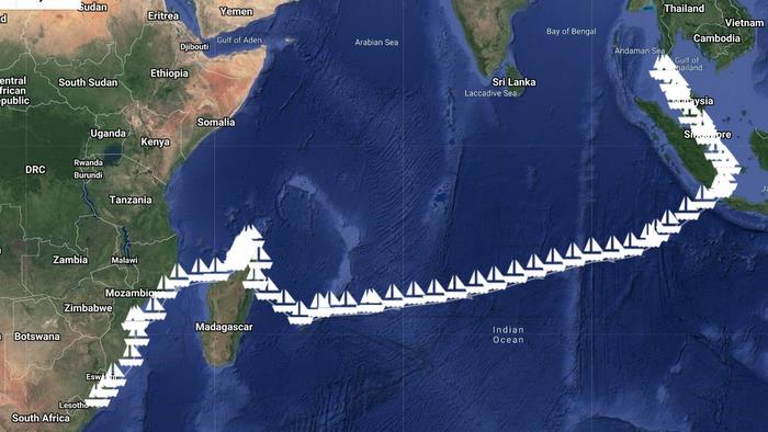
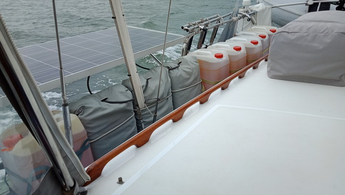
.jpg)
.jpg)
.jpg)
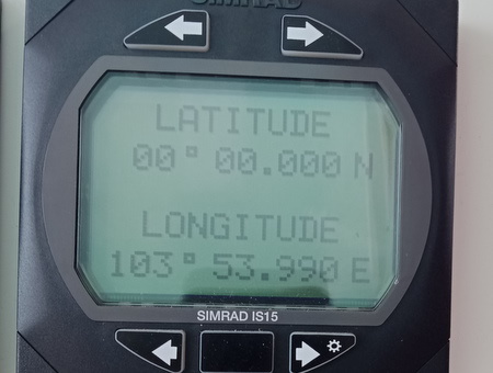
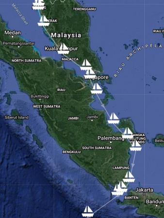
.jpg)
.JPG)
.JPG)
.JPG)
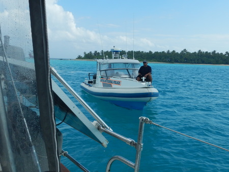
.JPG)
.JPG)
.JPG)
.JPG)
.JPG)
.JPG)
.JPG)
.JPG)
.JPG)
.JPG)
.JPG)
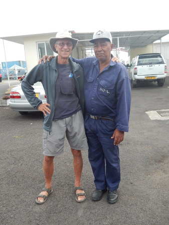
.JPG)
%20with%20Jefferson.jpg)
.JPG)
.jpg)
.jpg)
.JPG)
.JPG)
.JPG)
.JPG)
.jpg)
.jpg)
.JPG)
.JPG)
.jpg)
.JPG)
.JPG)
.jpg)
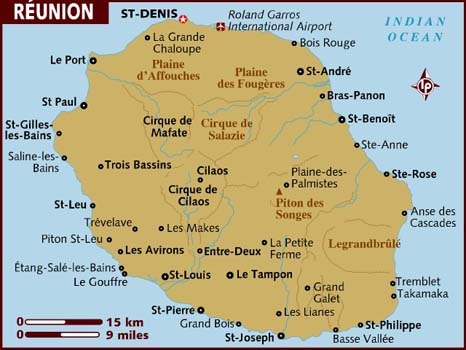
.jpg)
.JPG)
.jpg)
.jpg)
.jpg)
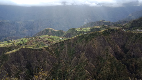
.JPG)
.jpg)
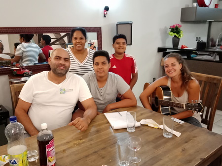
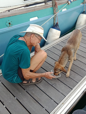
.jpg)
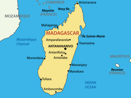
.JPG)
.JPG)
%20&%20sister%20Colleen.JPG)
.jpg)
%20-%20w-Aldino.jpg)
.JPG)
.jpg)
.jpg)
.JPG)
.JPG)
.JPG)
.JPG)
.JPG)
.JPG)
.JPG)
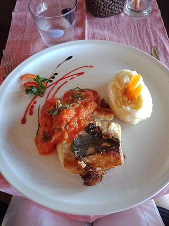
.jpg)
.JPG)
.jpg)
.JPG)
.JPG)
%20&%20Jimmy%20(R)%20(2).jpg)
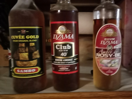
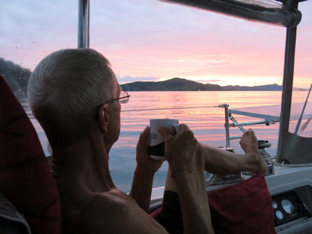
.jpg)
.JPG)
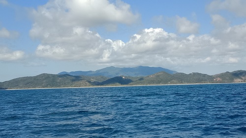
.JPG)
.JPG)
.JPG)
.JPG)
.JPG)
.JPG)
.jpg)
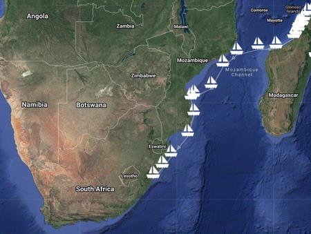
.jpg)
.jpg)
.jpg)
.jpg)