Logbook: Australia Part III - Queensland Coast from Moreton Bay to Thursday Island (May to July 2015)
In mid-May, we departed Moreton Bay (Brisbane area) and sailed north along the Queensland Coast of Australia, with our sights set on arriving in Cairns in Far North Queensland (FNQ) by June 10 for a scuba diving trip on the Great Barrier Reef. Cairns is about 850 nautical miles from Brisbane, and we had three weeks to get there - definitely do-able, but we wouldn't be able to move at our normal slow pace. We were, however, able to stop and enjoy several spots along the way, and the weather was fairly cooperative. Despite all the boat maintenance we did over the past couple of months, we battled a number of boat gremlins, which was frustrating. Once we reached Cairns, in addition to our scuba diving trip, we also did a short road trip, and in early July, we met up with the Sail2Indonesia Rally, an organized group of boats with which we would sail through Indonesia. After a month in Cairns, we continued north along the FNQ coast to Thursday Island, a port of entry/exit off the northeast tip of mainland Australia. In late July we bid good-bye to Australia and sailed off to Indonesia. For further details on our adventures (and misadventures) during these few months, read on...
Passage from Moreton Bay to Lady Musgrave Island (May 18 - 20, 237 nm, 1 day + 23 hours). We left Newport Marina mid-morning, saying good-bye to our home base for the past couple of months, and we motored across Moreton Bay in light winds. After spending two months parked in the marina, our propeller had a fair amount of growth on it, which slowed our boat speed a bit, but we rode an outgoing tide which gave us a boost. We chose not to clean the propeller before leaving the marina because we had been warned that there were bull sharks in those waters, and we didn't really want to chance any encounters with them. Our next stop was Lady Musgrave Island, where we expected to find clear blue water and no bull sharks, so we opted to deal with the slower boat speed until we arrived there and could clean the prop.
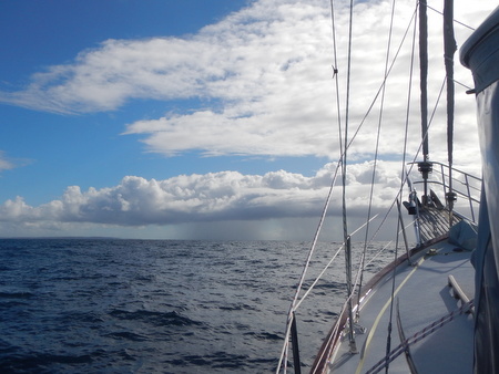
As we crossed Moreton Bay, we ran the motor for about three hours, checking the engine room on a regular basis, and Rich was pleased that the new coolant pump and hose he recently installed were working properly. As we rounded the southeast corner of Bribie Island and exited Moreton Bay, the wind came up from the southeast, and we set our sails wing-and-wing and turned off the motor. We sailed for the next 15 hours, but in the wee hours of the morning, the wind was dying out. Jan was on watch and kept the boat moving, albeit slowly, under sail. She was also keeping an eye on the radar and watching a squall moving toward us. The squall hit us around 4 a.m., and didn't have much wind in it, but it had lots of rain, and very quickly the wind shifted north. The noise of slatting sails and pouring rain woke up Rich, and he helped Jan furl the headsail, and we started the engine. Shortly after turning on the motor, Rich checked the engine room and saw coolant spraying out of the engine. Crap!! We turned off the engine and with very little wind, we drifted. We were not in a great location - we were on the outside of Fraser Island. The town of Mooloolaba was 70 miles south of us, and Bundaberg was 70 miles north of us. There was really nothing in between, and we were going nowhere fast.
Rich dove into the engine room and found that a v-belt from the alternator had been rubbing up against the new coolant hose and had put a hole in it. He tried a temporary fix with some Rescue Tape® and hose clamps, but that didn't work. Fortunately, he had saved the old coolant hose, and it was still in decent shape, so he dug it out of the v-berth and reinstalled it, this time making sure the v-belt wasn't rubbing up against it. Finally, at 6 a.m., the job was done - the old hose was back in place, the engine re-started, and everything looked to be running fine. Rich took over the watch, and Jan laid down to sleep for a few hours.
The following day was rainy with light winds. We continued to motor, with no further engine woes, although our hearts did skip a few beats at one point when the engine RPM's dropped for a few seconds, and then came back up to normal. We were guessing that we hit something in the water - perhaps a piece of line, or even a fish - but since the RPM's returned to normal, we felt reasonably confident (although not 100%) that everything was OK. Jan's second night watch was another adventure when she had to steer between two southbound cargo ships which passed within a half mile on each side of her at nearly the same time. Yikes!! The ship on her port side could not steer further to his starboard because there was an island in the way, and the ship on her starboard side couldn't steer further to his port because there was another sailboat he needed to avoid. Jan kept an eye on the ships' running lights and watched their progress on radar, and our AIS receiver provided the CPA (closest point of approach) for each ship. She also talked to both ship captains on the radio, and they could see our AIS signal coming from our newly installed AIS transponder. However, the situation was complicated by a couple of other factors. First, about an hour earlier, Jan noticed that our starboard running light had gone out. She advised the ship captains of that by radio, so our lack of proper running lights did not cause confusion. Also, our AIS receiver was giving us a bunch of error messages, and it was a challenge sorting through the error messages to get to the information she needed. Although Jan basically had it under control, she was feeling quite nervous when it was all happening and was extremely relieved when the ships were safely past. Rich slept through it all. A couple hours later, our starboard running light started working again.
Rain squalls while underway to Lady Musgrave IslandLady Musgrave Island (May 20 - 22). After our adventurous passage, we were quite happy to pull into Lady Musgrave Island. Lady Musgrave is an atoll, with a ring of coral encircling a lagoon and a small island in the northwest corner, and it is also a National Park. The entrance to the lagoon was well marked, and we motored in and dropped our anchor in a nice sandy spot. There were several other boats anchored in the lagoon, including a few tourist charters, but it was a spacious anchorage with plenty of room for everyone. The water inside the lagoon was beautiful - clear and blue - and after having spent two months in a marina, the tropical island feeling of this anchorage was quite welcome. Once we were anchored, Rich launched the dinghy, and he could see that we did indeed catch something on our prop. He didn't get a close look at it but told Jan that something was there.
Rich had some cleaning up to do in the engine room, so Jan jumped in the water to clean the prop. She dove down to take a look a it, and there was what looked to be a piece of rope about a meter long in the propeller. She easily unsnagged it and was swimming it to the surface to show Rich when she realized that she had a dead SNAKE in her hands! OMG!!! She released it and kicked away from it, thrashing up to the surface as fast as she could, and screaming as she went. Rich was on the side deck wondering what all this commotion was about. Once she told Rich about the snake and calmed herself down, she dove back down to the propeller to scrape off the encrusted barnacles, and Rich, once he quit laughing, went to work cleaning up the engine room.
Our friends Andy & Sue (s.v. Spruce) had also sailed up to Lady Musgrave Island from Moreton Bay, and we were looking forward to scuba diving with them here. The next day was beautiful and calm, and the four us of did a dive on the outside wall of the atoll. We didn't see anything unusual on the dive, but the water was nice and clear, the fish life was good, and it felt great to be back underwater again.
We weren't the only ones having a bit of bad luck - this schooner ran up on
the reef while motoring toward the pass to exit the lagoon at Lady Musgrave.
This is a charter boat, and the guests had to spend the night on board
waiting for the boat to re-float on the high tide. As far as we know,
the guests got home safely the next day.
Adult and juvenile trumpet fishes at Lady Musgrave
(photo taken by Sue of s.v. Spruce)
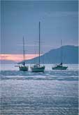
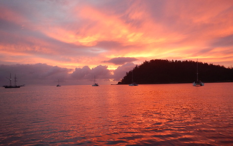
Lady Musgrave Sunset
Although we would have liked to stay longer at Lady Musgrave, we needed to keep moving north - Cairns was still 600+ nautical miles away. After spending two nights at Lady Musgrave, we were preparing to depart, and Rich checked the engine room and saw water in the bilge - $&!%!! He tasted it - salt water - where was it coming from?! We hunted around and found the problem. Shortly after anchoring at Lady Musgrave, as a couple of park rangers approached Slip Away in their small motorboat, Jan went below and turned the Y-Valve on our head discharge hose to go into our holding tank, so that we would be in compliance with their "no discharge" rules. The Y-valve didn't turn easily, and she mentioned to Rich that he should check on it, but then we spent a bit of time talking with the rangers, and we both forgot about it. It appeared that build-up in the Y-valve prohibited Jan from turning it completely, and the holding tank ended up filling with sea water and was now overflowing into our bilge. By some miracle, our boat did not smell like sewage! We turned the Y-valve back so that it would discharge overboard and once we were outside the lagoon, we turned on our macerator pump, to empty the holding tank - but it did not work. Just one more thing to fix!!
Great Keppel Island (May 23 - 25). From Lady Musgrave, we did an overnight run to Great Keppel Island (97 miles, 19 hours). We had light winds at the start of our passage so had to motor for a few hours, but once the wind arrived, it built quickly, and then we had a brisk passage under sail. We arrived at Great Keppel early in the morning and dropped our hook off Leeke's Beach on the north side of the island. The forecast was calling for a strong wind warning over the next couple of days, and this was a well protected spot to ride that out. Great Keppel has some excellent hiking trails and despite the strong winds (blowing 25-30 knots), we were able to get off the boat and do a couple of hikes. We took a short walk the day we arrived, and the next day we did a longer one out toward Bald Rock Point. This was another nice stop.
This homestead was built in the early 1920's, and the occupants ran sheep
on the island until the 1940's. It must have been a lonely existence!
Messages along the walking track
A windy day at Great Keppel Island
While here, we were sorting out yet another boat problem - this one with our VHF radio. Since leaving Moreton Bay, we'd been traveling up the coast with Andy & Sue on s.v. Spruce. During the passages, we would call one another a couple times a day on the VHF radio - just checking in to say hello and make sure all was well on board both boats. There were several times when we called Spruce and they could hear us, but when they called us back, we could not hear them. The problem was intermittent, which made it difficult to troubleshoot. Grrr....
Percy Islands (May 26-27). From Great Keppel, we did another overnight passage north to South Percy Island (102 nm, 19 hours). By this point, we had gotten far enough north that we had reached the southeast tradewinds, and they carried us north under sail.
We were planning to do a hike on Middle Percy Island the following day (after a good night's sleep) but had heard that the anchorage at Middle Percy could be quite rolly. Our cruising guide indicated that a good anchorage could be found on the north side of South Percy Island, so we decided to stop there to spend the night and continue to Middle Percy the next morning. We scouted out the north coast of South Percy and found what looked to be about the best spot and dropped our hook. We spent a quiet day on board Slip Away and joined Sue & Andy for dinner on board Spruce that evening. The anchorage was not rolly, but the boats moved around quite a bit due to strong tidal currents, and we could hear our anchor chain grinding on either coral heads or rocks.
The next morning, we intended to weigh anchor early and move up to Middle Percy, do the hike, and then leave again that afternoon. At 8 a.m., we started the engine and tried to weigh anchor, but our chain was snagged. We tried maneuvering the boat every which way to get the chain loose, but to no avail. Finally, Rich got out his scuba gear and went in the water. He spent about 30 minutes unraveling what he described as our worst wrap ever around some coral heads - there was no way we could have gotten free without diving on and unwrapping the chain. The current was fairly strong, so Rich made sure to keep a good hold of the chain while he unwrapped it. Visibility wasn't great, but he said there were some beautiful fishes swimming around the coral heads. Finally, shortly before 10 a.m., we were free and we had a nice sail up to Middle Percy Island (9 miles, 2 hours).
Middle Percy has an A-frame building on the beach, which serves as a "cruisers' shrine" where visitors can leave a token of their visit - t-shirts, burgees/flags, and other paraphernalia, including some nice wooden plaques, with boat names and dates of visits. We found items left by several boating friends, and we left a burgee to commemorate our visit. After visiting the A-frame, we did a walk around the island, which was quite nice, although we saw a number of downed trees, which were a result of an almost direct hit by Cyclone Marcia in February. The highlight of the hike around the island was walking through a migration of butterflies. We've never seen so many at one time - very cool! We finished our hike just before sunset, headed back to Slip Away, weighed anchor and continued north to the Whitsunday Island Group.
Cruisers' Shrine on the beach at Middle Percy
Damage from Cyclone Marcia
Rich is amazed by all the butterflies on the islandWhitsunday Islands. The Whitsunday Islands are a popular sailing destination for Australians. This group of over 100 islands cover a distance of about 100 miles along the coast and were created from a couple of drowned mountain ranges. The town of Airlie Beach on the mainland is the main centre where one can book a tour or charter a boat to visit the islands. There are some resorts scattered throughout the islands, and Hamilton Island is quite developed with an airport, but much of the Whitsunday Islands are designated as National Park. Now that we had reached the Whitsundays, we were just over 300 miles from Cairns, and still had 10 days to get there, so we felt like we could relax a little and enjoy this area for a few days.
Lindeman Island Group (May 28-29). After our overnight passage from Middle Percy (115 nm, 23½ hours), we arrived at the Lindeman Island Group in the southern Whitsundays. We wanted to do a hike on Lindeman Island the next day, but when we checked out the two anchorages on that island, both were quite rolly, so we anchored just a few miles away off Shaw Island. The anchorage at Shaw was flat calm - perfect for a good night's sleep. The next morning, we returned to Lindeman (5 miles away), dropped our anchor off Gap Beach and met up again with Sue & Andy (s.v. Spruce) for the hike. Locating the trail head proved a bit more difficult than we anticipated - we were surprised that there were no signs - but we finally found it and set off. In the past, there had been a Club Med resort on this island, but it closed down a few years ago, and it appeared that this hiking trail was no longer being maintained because parts of it were a bit overgrown. From the beach, we hiked along a trail which took us to the middle of the island and joined up with another trail which we intended to take to the lookout on Mt. Oldfield. As we arrived at the junction (about an hour into our hike), we saw a sign saying the trail was closed. We found it interesting that the authorities did not post that sign at the beach - who would start their hike in the middle of the island?! We ignored the sign and continued on to the lookout at Mt. Oldfield, which at 212 meters (about 700 feet), provided beautiful views over the island group. We spent a short time admiring the vista before a rain squall sent us scurrying for shelter. After the lookout, we continued along another trail that was so overgrown it was difficult to follow, but it eventually led to the abandoned Club Med resort, where we found a swimming pool full of frogs. On that trail, both Jan & Sue managed to brush up against some plants which had green ants on them, and both of them can attest that Australian green ants have a very painful bite! After walking around the abandoned resort for a bit, we headed back toward the anchorage taking a shortcut via the island's airstrip and avoiding the green ants.
View from atop Mt. Oldfield on Lindeman Island
Rich with Andy & Sue (s.v. Spruce)
Slip Away and Spruce anchored at Gap BeachWhitehaven Beach / Tongue Bay (May 30 - June 1). From Lindeman Island, it was a short hop to Whitehaven Beach (10 miles, 2 hours) through Solway passage. Slack tide conveniently occurred around 8 a.m. that day, so we got an early start and had the whole day to hang out at Whitehaven, which is rated as one of the prettiest beaches in the world. Whitehaven has a 5 km (3 mile) stretch of snowy white silica sand, and we anchored just offshore and headed in for a walk. We'd been forewarned to expect crowds of tourist boats at Whitehaven, but there were only a couple with very few day-trippers on board, and the beach is so huge that there was lots of room for everyone to enjoy this lovely spot. We've been fortunate to see a lot of really beautiful beaches in our travels, and this is certainly one of them.
Beaches don't come much prettier than this!
Variable Oystercatchers
Soldier crabs marching on the beachAfter our long walk on the beach, we headed back to Slip Away. The anchorage at Whitehaven is convenient for visiting the beach, but a bit rolly for spending the night, so we motored around the corner to anchor at Tongue Bay. When we entered in Tongue Bay, we noticed some swell coming into the bay - not a big swell, but enough so that if Slip Away got turned sideways to it, we would roll. So, we decided to set a stern anchor to keep the boat pointed into the swell - this way Slip Away would not roll, and her crew would be much happier!
The next day, we worked on a few boat projects (Rich fixed the macerator pump), and that afternoon, we dinghied ashore and did the short hike to a Whitehaven Beach lookout. On the trail, we met and chatted with the crew from a catamaran Mon Amie, also anchored in Tongue Bay - owners Fiona & Greg and their friends John, Jan and Ray. Fiona & Greg live in nearby Airlie Beach, gave us their telephone number and told us to call and come for dinner at their house when we got to Airlie. How nice!
View from the Whitehaven Beach Lookout - stunning, especially at low tide
Sunrise in Tongue BaySouth Molle Island (June 1). Before heading to Airlie Beach, we were planning one more stop at South Molle Island. After two nights in Tongue Bay, we weighed anchor in the early morning and motored in light winds to South Molle (9 nm, 2 hours). As we approached the anchorage, we saw another boat heading in the same direction - it was our friends Sue & Andy on Spruce! Their niece had joined them on board for a few days, and the five of us did a nice hike to the Spion Kop lookout. After the hike, the Spruce crew continued on to Airlie, but conditions were quite calm, and the anchorage at South Molle was quite nice, so we spent the night there.
The two of us at Spion Kop Lookout on South Molle Island
More butterflies!
Hiking on South Molle IslandAirlie Beach (June 2 - 4). The tradewinds had been quiet the past few days, but they were forecast to return in the morning, and the forecast was spot on. At about 6 a.m., the wind piped up to about 20 knots from the southeast. Our anchorage at South Molle was fine in those conditions, but the wind woke us up, and we wanted to get an early start. By 7:30, we were on our way to Airlie, an easy trip under sail with just our genoa (9 nm, 2 hours). Although the bay at Airlie has lots of moorings for local boats, there was a nice clear area for anchoring in front of the Abel Point Marina breakwall, with a public jetty inside the marina where we could tie up our dinghy. We were looking forward to the stop in Airlie Beach - this was the first town we'd stopped at since leaving Moreton Bay, so we were eager to find some fresh produce. We were also looking forward to visiting with Fiona & Greg, the couple we met on the Whitehaven trail.
Our first order of business upon arrival in Airlie was to find the post office because we needed to mail our passports and applications to the Indonesian consulate in Sydney to obtain our visitor visas, which were required before our arrival in Indonesia. The post office was about a 3 km walk from the marina on the outskirts of town, and it was located in a shopping center with a Coles grocery store, so we could pick up some fresh produce there. Rich was also happy to find that there was a Hungry Jack (Australia's Burger King) in that same center. We took care of business at the post office and stopped at Hungry Jack for lunch, which was mediocre at best, and the woman who waited on us was snarky. Jan informed Rich that would be her last visit to Hungry Jack, and although Rich loves Whoppers, even he had to admit that Hungry Jack's quality control needed some work. After a stop in Coles, we headed home, and that evening we called Fiona and made plans to see her and Greg the following night.
The next morning, Jan took advantage of the marina laundromat to do a couple loads of laundry, and this time she chose the spot for lunch - a Spanish cafe in the marina, where we enjoyed some delicious plates of tapas (much better than Hungry Jack!). In the afternoon, we walked into Airlie's downtown area, which was quite lively with tour agencies, souvenir shops and backpackers. There was also a very nice Woolworths grocery store in the downtown area, and we picked up a few more groceries. That evening, we went to Fiona & Greg's for dinner. They have a lovely apartment (what we would call a condo) in the marina. Dinner was outstanding, and we had a fantastic evening talking about travel, sailing, scuba diving, wine, and a variety of other topics. It wasn't until late in the evening that we learned that Fiona is a doctor - a specialist in lung transplants! Although the evening was delightful, we went home with heavy hearts. Fiona's husband Greg was diagnosed 18 months ago with dementia, and it has progressed rapidly - and he is just 60 years old! They too had a dream to travel on their sailboat, but that's obviously no longer an option. Situations such as theirs give us an incredible appreciation for our good health and good fortune.
Horseshoe Bay, Magnetic Island (June 5 - 8). Our short respite from overnight passages was over; it was time to get moving again. We left Airlie Beach and headed to Magnetic Island off the coast of Townsville (131 nm, 24 hours). Winds were fairly light for most of this passage (10-12 knots), but with gentle seas, we enjoyed a lovely sail north.
Magnetic Island was another destination where we wanted to linger for a few days. Horseshoe Bay is a good anchorage, and much of the island is National Park with several good hiking trails. Koalas were introduced on this island in 1932, and the present population numbers around 800, so we were hopeful that we might have another opportunity to see them in the wild. Our friends Matt & Jean (s.v. Superted) and Gerrit & Anne-Mieke (s.v. Fruit de Mer) would also be at Magnetic Island when we got there, and we were looking forward to catching up to them.
We arrived at Horseshoe Bay late morning, dropped our hook and settled in. Our timing was such that we arrived in Horseshoe Bay at the same time as the Coral Coast Yacht Race & Rally (which also sailed from Airlie Beach). There were over 50 boats in the Horseshoe Bay anchorage, but it is a very large bay and did not feel crowded. The afternoon of our arrival, the crews of Superted and Fruit de Mer joined us on board Slip Away for happy hour and an opportunity to catch up. Earlier in the day, Gerrit & Anne-Mieke had gone for a hike in search of koalas, but the fuzzy little critters eluded them.
Over the next couple of days, we did two fairly long hikes, both of which were quite enjoyable, but despite our best efforts, we didn't see any koalas. We talked to a number of other hikers, and no one else had seen any either. We were quite happy, however, that we also never saw any death adder snakes, which also live on this island. Our last day on Magnetic Island was Rich's birthday, and after breakfast, we headed out on a hike which took us to Nelly Bay on the opposite side of the island. There we found a cafe for lunch, and then we took the bus back to Horseshoe Bay, where we stopped at Adele's Cafe for dessert - a waffle topped with vanilla gelato and maple syrup. Yum!
Beautiful day for our hike on the Forts Track, but no koala sightings
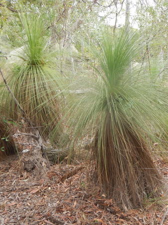
Interesting grass trees
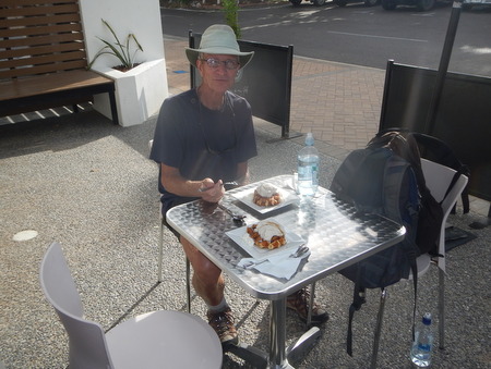
Rich's yummy birthday dessertHinchinbrook Island (June 8 - 9, 60 nm, 11 hours). From Magnetic Island, we continued north to Hinchinbrook Island. Our cruising guide described the channel between Hinchinbrook Island and the mainland as "the most scenic, calm waterway on the east coast of Australia," so we thought we'd check it out. Sixty miles is a long distance for a day sail, and we also needed to arrive at the southern entrance of the channel near high tide which occurred early in the afternoon, so we left Horseshoe Bay at 3:30 a.m. The weather forecast was calling for 20-25 knots of wind, so we were expecting a lively passage, but we ended up with only 10-15 knots of southeast wind, and it was a pleasant downwind sail. We arrived right on time to enter the channel just before high tide, and we continued up the channel for about 8 miles and dropped our anchor near Haycock Island, a small islet in the channel. It was a delightfully calm anchorage, although in retrospect, we should have anchored a bit further away from the mangroves because we had a few mozzies (Australian for mosquitoes) that evening. In any event, after our long day, we turned out the lights early, and we had a nice calm anchorage for a good night's sleep.
Passage from Hinchinbrook Island to Cairns (June 9 - 10, 122 nm, 25½ hours). Our deadline for arriving in Cairns was looming, but we were right on schedule. One more overnight passage, and we would be there. We weighed anchor at Haycock Island mid-morning and continued up the Hinchinbrook Channel for 18 miles. As promised, it was very scenic, with the peaks of Hinchinbrook Island to the east and the Cardwell Range to the west. Crocodiles inhabit these waters, and we kept our eyes peeled for them but saw none.
Anchorage near the small Haycock Island
Peaks of Hinchinbrook IslandWe exited the north end of the channel, set our sails and continued on to Cairns. The weather forecast for this passage was more accurate than the last one, and our trip was quite boisterous, with mostly 20-25 knots of southeast winds, and a couple of hours of 25-30. We also had heavy rain at times, and the seas were quite lumpy. Neither of us got much sleep that night, but it was a fast passage. We arrived Cairns just at daybreak, and although we had a berth reserved at the Marlin Marina, we wouldn't be able to get into our slip until the marina opened later in the morning. Our cruising guide described the Mission Bay anchorage just outside the marina as having only a "little swell during strong tradewinds," so we headed there to drop our hook for a few hours. The anchorage was actually quite rolly, but we managed to get a couple hours of sleep before weighing anchor and heading into the marina. We were nervous going into the marina with the strong winds, but the marina was well sheltered, and we docked the boat with no problem.
Cairns (June 10 to July 9). Cairns is the northernmost major town in Australia, and it's actually closer to Papua New Guinea than it is to any of the major cities in Australia. Jan had visited Cairns on her trip to Australia in 1991, but it has changed quite a bit since then. In 1991, it was a small-ish town with a few hotels and dive shops. Folks who went to Cairns were mostly there to dive or snorkel on the Great Barrier Reef. But Cairns had grown up quite a bit in the past 24 years. There are many more hotels, more dive shops and lots of other tourist agencies, numerous cafes and restaurants and a beautifully developed waterfront area. The marina was situated on the edge of town, and we could walk pretty much everywhere. Although Cairns is a tourist town, it didn't feel like a "tourist trap." We really liked it.
Great Barrier Reef Dive Trip (June 12 - 16). We arrived in Cairns two days before the start of our scuba diving trip - just in time! Since we enjoy diving so much, we didn't want to leave Australia without diving on the Great Barrier Reef (GBR). Although there are numerous day trips for diving the GBR, the better dive sites are farther afield, and a live-aboard dive boat was the only option for getting to them. The week-long live-aboard trips were too expensive for us, but we found a four-day trip that visited some of the top dive sites and was within our budget.
After settling Slip Away in the marina, we packed our gear and were off. We were excited about the trip, but not thrilled about the weather forecast. The weather in June is supposed to be reasonably good. Normally, it's a dry time of the year, and the tradewinds have not yet built to peak strength. But, the weather forecast for the next few days was calling for strong winds and some rain - bummer! We weren't too concerned, however, because we would be on a 100-foot motor yacht, and we didn't have to stand watch or worry about the anchor! We expected the foul weather would diminish visibility on the dives, but we were on "vacation" and determined to have a good time - and we did.
We spent four days on board the Taka II Explorer with a group of 30 guests and 10 crew - nice ratio! We could do up to a total of 14 dives; Jan did all but one dive, and Rich did all but two. The diving was very good - not the best diving we've ever done, but we do recognize that we are very spoiled! We saw some things we've never seen before, including a couple of pygmy octopus and olive sea snakes (yikes!) We also saw a clown fish ("Nemo") for the first time. We've seen many anemonefish (clownfish cousins), but this was the first true clownfish. But the highlight of the trip (at least for Jan) was an opportunity to swim with Minke whales. It was Minke whale migration season, and we had whales swimming around the dive boat on three of the four days of our trip. Only a few dive operators are licensed to allow their guests to swim with the whales, and ours was one of them. In reality, we didn't really swim with the whales, we floated. The dive boat put a couple of long lines out to the side, and we hung on to the lines and floated while the whales swam around us. There were lots of rules - no touching, no swimming to get closer to the whales, etc., but it was a great experience! In addition to the diving, we met some really super people on this trip.
Taka II Explorer
Clownfish - Nemo & Marlin
Swimming with the Minke Whales
It was such a thrill to see a whale swim by!
Pygmy Octopus - we love the little stuff too!
Divemaster Tim feeding the large potato cod at the Cod Hole dive siteAfter our dive trip, we spent a week back in Cairns, chasing after boat gremlins and enjoying the town before renting a car and heading off on a short road trip to the Daintree and Cape Tribulation National Parks and the Atherton Tablelands.
Daintree and Cape Tribulation National Parks (June 23 - 24). The Daintree and Cape Tribulation National Parks lie along the coast about 1½ hours north of Cairns by car (unless of course, you run into a lot of road construction like we did!). These national parks are World Heritage Areas and are significant because they contain some of the oldest rainforest on earth, dating back over 100 million years to the Cretaceous era. It was in these forests that flowering plants first appeared on earth! We've seen some rainforest in our travels, but this was some of the densest we've ever experienced, and it lived up to it's name - it was very rainy! Also, just an interesting fun fact - Cape Tribulation was so named by Captain James Cook because it was here that he ran his ship Endeavour up on a reef.
A guy we met on our GBR dive trip told us about a crocodile tour - Solar Whisper Boat Tours - on the Daintree River at the southern edge of the rainforest, and it sounded like fun, so that was our first stop. Despite the delays we experienced with road construction, we still managed to time our arrival near low tide, which is the best time for sighting the crocs because they haul themselves on to the shore at low tide to sun themselves. The day of our tour was pretty rainy, so there weren't a lot of crocs sunbathing, but we did see three - a large female, a "teenager" and a baby, as well as a couple of snakes hanging out in the trees, and a frogmouth (looks a bit like an owl). It was a fun and interesting tour, with the guide telling us lots about the crocs (they have names for all of the adults) and other wildlife in this area.
After the croc tour, we took the ferry across the Daintree River and continued north. Because the rainforest is so dense, there were no long hikes in this park, but there were several short walks, so we stopped and did a few of those as we drove toward Cape Tribulation. We kept our eyes peeled for wildlife and were rewarded with the sighting of a cassowary mother and chick on the side of the road.
We had booked a cabin at the Ocean Safari Jungle Lodge in Cape Tribulation, and we checked in late afternoon. Accommodations were few and expensive in the park. For AUD $90 (USD $70) per night, we stayed in a campground cabin, which was fairly new and quite nice with a king size bed, but we did have to use the campground toilets and showers, which were a short walk away. Jan made one run to the toilets in the middle of the night and was on high alert for snakes, but thankfully didn't see any. The campground also had a camp kitchen, and we had brought some food and intended to cook our own dinner, but the pots and pans looked a bit grotty. PK's Jungle Village was across the street and was having a two-for-one pizza night with reasonably priced pitchers of beer, so we had pizza and beer for dinner instead.
Large female croc named Margaret
Rainforest walk in the Daintree
We kept a sharp lookout and stayed away from the water's
edge while walking on the beach at Cape Tribulation
Enjoying a happy hour beer on the porch of our Jungle Lodge cabin
Mum & Chick Cassowaries
More beautiful rainforest at Cape TribulationWe spent one night at Cape Tribulation and then retraced our route south. It was another rainy (but still very beautiful) day in the rainforest, and we saw another cassowary meandering along the side of the road. After ferrying across the Daintree River, we stopped at Mossman Gorge, which sits at the southern end of the Daintree National Park. By the time we arrived there, it was pouring. Mossman Gorge is an area of spiritual and cultural value to the local Aboriginal tribes, and it has a nice visitor center and lovely 5 km hiking trail. We looked around the visitor center for a bit, and by then the rain abated enough that we felt we could walk the trail (with umbrellas). After our walk, we enjoyed a nice lunch at the visitor center cafe.
Wet trail through the rainforest at Mossman Gorge
Mossman River cutting through the gorgeAfter lunch, we headed back toward Cairns and as we drove south, the weather improved, so we stopped to walk a few trails at the Cairns Botanical Gardens. We would be continuing on to the Atherton Tablelands the next day, but since our route there took us back toward Cairns, we decided to spend the night on board Slip Away rather than in a hotel.
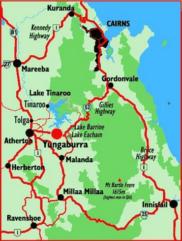
Atherton Tablelands / Cairns Highlands (June 25 - 26). The Atherton Tablelands were also once covered in dense rainforest, but volcanic eruptions destroyed the rainforest, and the area's rich volcanic soil now supports significant agriculture. Starting from Cairns, we drove a big loop, which first took us northwest through the mountain town of Kuranda, then west via the Kennedy Highway over the Great Dividing Range and south into the heart of the Tablelands. We spent one night in Yungaburra and returned to Cairns by heading south through Malanda and Millaa Millaa and then east via the Palmerston Highway to Innisfail, and the Bruce Highway brought us north back to Cairns. There was a lot to see along this route, and we made several stops.
We departed Cairns about 8 a.m. and enjoyed the drive up the mountain roads to Kuranda. We arrived in Kuranda about 9 a.m. and thought we might stroll around the town and have a coffee before attending a 10 a.m. Aboriginal Cultural Show, but the town was still asleep! So, we drove out to Baron Falls and enjoyed the view. We didn't have enough time to do the canopy walk at Baron Falls, but it appealed to us, so we decided to come back after the show.
The Aboriginal Cultural Show at Rainforestation was quite good. There were demonstrations of playing the didgeridoo, throwing spears and boomerangs, and it ended with a traditional dance show. Up to this point, we felt that our Australia experience was lacking in exposure to the Aboriginal culture, so this was a good opportunity for us to learn a bit more. After the show, we returned to Baron Falls and did the canopy walk, and then we went back into town for lunch.
Didgeridoo demonstration
Rich tries his hand at throwing a boomerang
Barron Falls
Jan had also visited Kuranda on her Australia tour in 1991, and like Cairns, it too had grown quite a bit. To us, Kuranda had a bit of a split personality. On the surface, it appeared to be a hippie village in the mountains. But, tourism had taken hold here, and the streets were lined with shops selling clothing, Australian Opals, wood carvings and lots of other things we don't have room for on the boat. There are also walking tours, "duck tours" (in amphibious ex-army vehicles) and numerous other attractions. Kuranda had a bit of a "tourist trap" feel to us, so we didn't need to spend much time here, and after lunch, we continued on.
Not all cultures use "western style" toilets, so towns which get a lot of
foreign tourists (like Kuranda), need to provide user instructions.From Kuranda, we headed further into the Tablelands. We stopped in the town of Atherton and visited the Tourist Information Centre, where we picked up some information on walks in the area, and then continued on to the town of Yungaburra. We had booked a room at the Lake Eacham Hotel (locally known as "The Pub"), an old historic hotel. The hotel was a bit run down, but very charming, and the room rate was reasonable - AUD $60 (USD $46) per night for a room which was small, but it had an ensuite bathroom and shower, and included continental breakfast. After checking into our hotel, we drove out to see the famous "Curtain Fig Tree" and then spent a couple of hours walking along Peterson Creek looking for platypus. Rich caught a fleeting glimpse of one, but Jan missed it. We met and spoke to a number of people along the trail - everyone looking for platypus but not having any luck with that.
Historic Lake Eacham Hotel
Curtain Fig National Park
The platypus in Peterson Creek were very elusive creaturesThe Pub was a popular place for dinner in Yungaburra, and that night we enjoyed their pork roast dinner special - AUD $12.99 (USD $11.60) - a healthy serving of meat on a pile of potatoes and veggies and covered in gravy. We cleaned our plates and were stuffed! Before and after dinner, we sat by the fireplace (it was cold here!), and chatted with a few guys (also hotel guests) who lived near Cairns but were here working on sewer lines. We couldn't always understand everything they were saying to us (very strong accents aided by alcohol), so we found ourselves nodding and smiling a lot as they told us some of their life stories, but they were friendly guys and we had a fun night.
The next morning, we headed out to see more of the area and do a few walks. We started with a 3 km walk around Lake Eacham, which was very pretty, and we loved hearing the calls of several whip birds. We looked for saw-shelled turtles in the lake, a freshwater turtle which is native to this area, but we didn't find any. We were intrigued by these turtles because they can breathe through their butts! From Lake Eacham, we headed to Malanda Falls and did a walk while searching for tree kangaroos. We didn't see the tree kangaroos, but we did see quite a few of the saw-shelled turtles in the river. We stopped at the Tourist Information Center at Malanda Falls, and were lamenting that we hadn't seen a tree kangaroo, and the folks there recommended that we visit the Nerada Tea Factory. They told us the Tea Factory had great tea and scones, and a family of tree kangaroos lived out there. So, that's what we did, and as we were walking up the path to the cafe, a tree kangaroo bounded across the lawn and climbed a tree! Wow - very cool! The tea and scones were delicious, and we learned a bit about growing tea - something we knew absolutely nothing about. From Nerada, we headed to Milaa Milaa, and drove their "waterfall circuit" visiting three beautiful waterfalls - and hiking a very slippery trail to the bottom of the Zilla Falls. After the waterfalls, as we worked our way back toward Cairns, we stopped to enjoy the view at Crawfords Lookout and made a final stop for a walk at Babinda Boulders.
Very deep and very blue Lake Eacham
Butt-breathing Sawtooth turtles
Kookaburras at Malanda Falls
Two of us at Ellinjaa Falls
Tree Kangaroo
Babinda BouldersWe arrived back in Cairns in time to get to the SuperCheap Auto Parts store, where we picked up a few gallons of distilled water for our boat batteries - it was nice not to have to carry those back to the boat in our backpacks! As we pulled into town, we got a text from our friends Heather & Jon (s.v. Evergreen) letting us know about a spaghetti dinner at the Cairns Yacht Club. Perfect! We joined them and several other boaters for a fun night out.
Back in Cairns. After our road trip, we spent a couple more weeks in Cairns. We continued to do boat maintenance - still sorting out a few of the gremlins from the trip up the coast and completing a couple more "to-do" list items which we didn't get to in Newport Marina. Jan also topped up our stores of provisions, replacing the items we had used since leaving Brisbane, and stocking up on the more perishable items like meats and cheeses. She took advantage of an offer for free delivery from the local Coles grocery store, and she ordered a freezer full of meat from a local butcher, also delivered to the marina for free.
We were also really enjoying the town of Cairns. The esplanade along the waterfront was a nice place to walk, the grocery store was an easy walk from the marina, and since Cairns is popular with backpackers, there were some affordable restaurants in town. McDonalds was only a couple blocks away, and while both of us enjoyed their ice cream cones, Rich was especially happy that he could go for a short walk in the morning and get himself a Sausage & Egg McMuffin. Rusty's Market (weekends only) had fantastic fresh produce, and the Night Market (every night) was an entertaining place to meander, do some souvenir shopping and get a cheap massage. One of our favorite places for happy hour was the nearby Pier Bar, which offered pints of beer for AUD $5 (USD $4) every day from 5 to 7 p.m., as well as delicious pizza. The best meal we had, however, was at the Salt House Cafe, which was part of the marina complex. At first, we avoided the Salt House thinking it was too expensive, but they had a sign out front advertising AUD $3.50 (USD $2.75) beers for happy hour (5 to 6 p.m. only) and 2 for 1 meals Monday through Wednesday. On our last night in Cairns, we went to the Salt House for happy hour and an early dinner - delicious fresh Spanish Mackerel - and we were kicking ourselves for not having tried this place sooner!
Although the Marlin Marina was in a convenient location, the biggest negative about it was the noise. Helicopter tours of the Great Barrier Reef took off several times a day from a spot not far from our marina berth - all conversation ceased when that was happening. Also, with an active nightlife in Cairns and some of the hot spots nearby the marina, there was often loud music playing until the wee hours of the morning. Fortunately, the weather was cool enough that we could close most of our hatches to minimize the noise so that we could sleep at night.
In early July, activities and festivities got started for the Sail2Indonesia Rally. Shortly after we arrived in Cairns, other boats for the rally started arriving. We knew only two of the other boats signed up for this rally, and there were over 50 total boats registered, so we were meeting lots of new people. The rally hosted a couple of gatherings at the Cairns Cruising Yacht Squadron, where we took care of some paperwork details and learned a bit more about the places we would be visiting in Indonesia. The final rally event was a "Parrothead Party" with a local band called the Barbary Coasters singing Jimmy Buffett hits.
Barbary Coasters playing Jimmy Buffett music
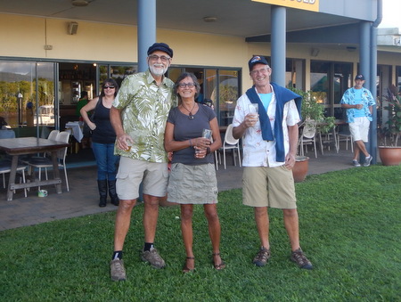
Xavier (s.v. Windkist), Lorie (s.v. Kind of Blue) and Gerrit (s.v. Fruit de Mer)After the rally events, it was time to get moving. We had 1½ weeks to sail north to Thursday Island (TI), where we would clear Australia Customs and set off for Indonesia. Total distance from Cairns to TI was 400 miles, so we didn't have to rush. As so often happens, we were one of the last rally boats to leave Cairns.
Many of the rally participants opted to do day-sails north to TI, which meant traveling pretty much all day every day and just stopping to sleep at night. On our way from Brisbane to Cairns, it worked well for us to do some overnight passages, stopping at fewer places but covering longer distances in a single passage and giving us an opportunity to explore a bit ashore. We chose to do that again as we worked our way north to TI - one way is not better than the other; it's just a matter of personal preference. The route from Cairns to TI required strict attention to navigation because we were traveling through some reef-infested areas, but Australia's waters are well charted, and we were able to follow shipping lanes as we headed north. The shipping lanes were quite narrow in spots, and we hugged the starboard side of the channel, so that southbound ships passed us port to port and northbound ships left us on their starboard side when they overtook and passed by us. (Although Australians drive their cars on the left side of the road, international navigation rules require driving on the right.) The shipping lanes were fairly busy - we'd usually see 4 or 5 ships every day - but we had no problems. We had a replacement AIS transponder shipped to us in Cairns, so were no longer dealing with error messages, which was also quite helpful!
Passage to Lizard Island (July 9 - 10, 143 nm, 143 nm, 24½ hours). Before departing the Cairns Marina, we topped up our fuel supply (both diesel and gasoline) at the marina fuel dock, and then motored out the channel. We departed Cairns mid-morning, and winds were light at first, but the sea breeze filled in quickly. We set our sails wing-and-wing and sailed north to Lizard Island. We had great sailing conditions with the tradewinds blowing from the southeast in the high teens to low 20's. The seas were uncharacteristically flat because the Great Barrier Reef provided protection from the ocean swell. We enjoyed these excellent sailing conditions pretty much all the way from Cairns to TI.
Lizard Island (July 10 - 13). Lizard Island was a place we wanted to stop and visit for a few days. There is a good anchorage at Watson's Bay, and Lizard Island is a National Park with several hiking trails. There are also a number of spots to snorkel and dive around Lizard, but Jan was banned from the water because of an infected toe - she wore some skin off the top of one of her toes on our GBR dive trip, and despite her best efforts to avoid an infection, she developed a tenacious one which required two rounds of antibiotics. The toe was nearly healed, but water sports were off limits for her for a bit longer. Rich did get in the water here, but only to clean the prop and boat bottom. There were no snakes on the prop this time, although we later learned of the occasional crocodile sighting at Lizard Island. Yikes! Fortunately, there were none during our stay, and we were told that they would normally hang out in the mangrove areas, not out in the bay where we were anchored.
Captain James Cook visited here in 1770 and named it Lizard Island because of the large number of sand lizards. During our visit, we hiked to Cook's Lookout on the peak of the island (359 meters or 1200 feet above sea level). From up high, Captain Cook was able to see a break in the GBR through which he could sail his ship. The hike was challenging - only 2.5 km, but steep and with loose footing in places, but we took it slowly and the exercise felt good.
There is a resort on Lizard Island, but it was closed for reconstruction, having suffered some damage from a couple of cyclones over the past couple of years. There is also a Great Barrier Reef Research Station on the Island (opened in 1973), and on our last morning here, we were invited to a presentation there which was very interesting and informative.
Watson's Bay Anchorage on Lizard Island
We had to hike half-way up the hill to get a good internet
signal (nothing from the anchorage). We called this our
internet cafe, but unfortunately, there was no coffee served!
View from Cook's Lookout
Lizard Island's namesake
Lyle, one of two Directors at the Lizard Island
Research Station, is originally from Minnesota, but he
has been working here since the station's inception
Interesting Stuff
Flinders Island (July 14 - 15). We left Lizard Island late in the afternoon for an overnight passage to the Flinders Group (83 miles, 14½ hours), dropping our anchor in Owen Channel between Stanley and Flinders Islands. Our friends Jon & Heather (s.v. Evergreen) had arrived late the previous day, and when we pulled in, we launched our dinghy and headed off with them in search of a hiking trail with some Aboriginal carvings on Stanley Island. Unfortunately, due to the tides, we couldn't access the shoreline, so we scratched that idea. Flinders Island looked accessible via a sandy beach, so we opted for a walk on that island instead. We have wheels on our dinghy which helps us to pull it up on a beach, but when we put them down and approached this beach, the area just beyond the sand was soft sticky mud, and our wheels got stuck. It was a bit of an ordeal trying to get the dinghy ashore with our feet also getting stuck in the mud. This was not what the doctor ordered for Jan's toe! Fortunately, it had healed enough to suffer no ill effects from the adventure, and we eventually made it ashore and did our walk. The other concern we had was that we were in crocodile country, so we didn't really want to be hanging out in the water, but happily, there were no crocs present that day.
Heather & Jan at the "HMS Dart 1899" rock carving, the legacy of a
naval ship that visited here to collect water from the wells on Flinders Island
Margaret Bay (July 16 - 17). After spending the night at the Flinders Group, we left early the next morning for an overnight passage to Margaret Bay (164 nm, 1 day + 4½ hours). We spent a day here, and although there was a walk ashore, we opted to stay aboard Slip Away and work on a couple of boat issues. On our passage here, the problem with our VHF radio had started up again. While we were in Cairns, Rich had gone up the main mast and cleaned the antenna connection, and we thought that solved the problem because the radio had been working since then. Electronics problems can often times be attributed to corrosion in the connections, especially because they are subjected to some pretty harsh conditions. However, because we weren't sure if that would solve the problem, we purchased a spare VHF radio. We were able to order our exact same model from Amazon.com and have it shipped to us at the marina in Cairns. Even if the problem was not the radio, we figured that it wouldn't hurt to have a spare VHF on board. Rich installed the new radio here in Margaret Bay, and we had our fingers crossed that would solve the problem, but it did not. So, we needed to replace our VHF antenna, and we weren't smart enough to purchase a spare one of those.
Underway to Margaret Bay with s.v. Evergreen on a rare light-wind morning
Fishing boats with which we shared the anchorage at Margaret Bay
Horn Island / Thursday Island (July 18 - 19). From Margaret Bay, we sailed north on the final leg of our journey along the Australian Coast. We passed through the narrow Albany Passage (timing it right for 2 - 2.5 knots of favorable current), then sailed "over the top" of Cape York and on to the anchorage at Horn Island, just across Ellis Channel from Thursday Island (109 nm, 19 hours). The anchorage at Horn wasn't ideal - it was crowded with rally boats, holding wasn't great, and there was quite a bit of current, which changed directions with the tides - a recipe for dragging anchors. But, overall the fleet did a very good job of managing the situation, and we all kept an eye on each others' boats, which proved to be quite useful when a couple of boats' anchors dragged while the owners were not on board. We were aware that there was a chandlery at TI and were hopeful that we might be able to pick up the new VHF antenna there, but unfortunately, our timing was off because we were arriving TI late on Saturday afternoon, and the chandlery was closed on Sunday. However, we spoke via the SSB radio to Jorge (s.v. Don Leon) who was going to the chandlery on Saturday morning, and he volunteered to see what he could find for us. Rich gave him the specifications of what he wanted, and Jorge was not able to find an exact match, but he found one that would work for us temporarily. Thank you Jorge!!
Slip Away approaching the Albany PassageThursday Island was quite different from the other areas of Australia we had visited - it was less "first-world", dry and dusty and not particularly appealing, so we didn't have a huge desire to hang out here for long. There was no swimming here because there were crocs - we saw a big one sunning himself on the beach during the day. Nevertheless, we needed to take care of some business here. We scheduled an appointment with Customs on TI to do our clearance paperwork on Monday afternoon, and that morning we went ashore on Horn Island to take care of a few errands. Rich went off in one direction to get our diesel jerry jugs filled - since we'd had such great sailing winds coming up the coast, we didn't need a lot of fuel, but we wanted to top off our tanks before leaving for Indonesia. Jan went off in another direction to drop off some laundry to be done at a local guesthouse. After our busy morning, we caught the 11:30 a.m. ferry from Horn Island to TI, and found a cafe on TI where we enjoyed lunch with Gerrit & Anne-Mieke (s.v. Fruit de Mer) and Jon & Heather (s.v. Evergreen). After lunch, we walked around TI for a bit, and from a hilltop, we could see smoke from a fire on Horn Island. The fire was far enough away from the anchorage that there was no danger to the boats, but the smoke was blowing right through the anchorage, and we could foresee a very smoky and smelly night.
Crowded anchorage at Horn Island
View from Thursday Island looking across Ellis Channel to Horn Island
with smoke from the bush fire blowing toward the anchorageSlip Away and Evergreen had late afternoon appointments scheduled with Australia Customs, but we ended up showing up at their office an hour ahead of time. As we had hoped, they had enough time between scheduled appointments that they were able to squeeze us in. The rally did a good job of organizing an efficient check-out process here because we completed most of the Customs forms in Cairns, so checkout was easy and went quickly. After finishing with Customs, we stopped at the grocery store and bought as much fresh produce as we could find (although it was slim pickings!), as well as a loaf of bread (sold frozen on TI) and some pricey eggs. We caught the ferry back to Horn Island, and Jon and Rich hung out with the groceries in the dinghies, while Heather and Jan walked through the smoke-filled dirt roads to pick up the laundry. Fortunately, the guesthouse dried the laundry in a dryer, so it didn't smell like smoke.
The smoke in the anchorage that night and the next morning was not dangerous, but it was quite unpleasant. The next morning, Rich decided to take advantage of the free fresh water available at the ferry dock and hauled several jerry jugs to save some watermaker run time, but after doing so, his throat was sore and he was feeling nauseous. We didn't really want to leave until early afternoon because we wanted to time our departure with an outgoing tide rather than fight a strong adverse current. However, we had a few moments when we questioned whether fighting a current was worse than breathing the smoke! Finally, in the early afternoon, it was time to go. We were the last boat to leave the anchorage that day, although there were a few who weren't leaving until the next day. It didn't take long once we left the anchorage to get out of the smoke, and then we enjoyed a very fast ride. As we sailed across Normanby Sound, our boat speed was reading 6.5 knots, but our speed over ground was 11.1 - woo hoo!
We said our good-byes to Australia as we sailed off. We'd just spent over eight months in the land of OZ, and with the exception of that smoky send-off, it had been an awesome time!
Reflections on Australia:
As we sailed across the South Pacific over the past few years, Australia was a bit of a question mark for us. Although we wanted to visit Australia, we had some reservations.
First, there was the cost. Everything we heard told us that Australia is an expensive place to visit. A few years ago, the Australian dollar was quite strong and was worth more than the American dollar. In 2012, the ratio was AUD $1.05 to USD $1. But we were quite fortunate in our timing, as the Australian dollar dropped in value shortly before our visit (AUD 88 cents to USD $1 when we arrived) and continued to decline while we were there (AUD 77 cents to USD $1 when we left), which made things a bit less expensive.
We'd also heard some negative reports about Australian Customs from other cruising sailors. More than one person told us that Australian Customs treated incoming international yachts poorly, literally tearing their boats apart when they arrived. There may have been some small shred of truth to those rumors ten or more years ago, but Australian Customs has worked on improving their image, and recent reports were much more positive. Before sailing to Australia, we familiarized ourselves with their requirements and followed their rules. We provided the appropriate "Advance Notice of Arrival" to Customs, applied for and secured our visitor visas on-line, brought in only the amount of liquor they allowed and consumed all of our fresh produce and meats before arrival and/or surrendered any leftovers. When we arrived in Bundaberg, the Agriculture Officer was very thorough in his inspection of our boat (looking for "exotic" termites), but he did not tear our boat apart. The Customs Officers were very friendly, did their paperwork and went on their way, just asking that we inform them of our whereabouts every 90 days (which we did). Overall, our experience with Customs and Quarantine was very positive. And, dealing with Australia's Immigration Department was quite easy and not nearly as restrictive as a lot of places we've visited. Most of the countries we have visited offer a 90-day visitor visa upon entry, which sometimes can, and sometimes cannot, be extended. We were able to secure a one-year multiple-entry visa to visit Australia, and we did it all on-line. The on-line application was lengthy, but not difficult, and the cost was USD $123 per person, which we thought was very reasonable.
So, in the end, we decided not only to visit Australia, but also to stay for an extended amount of time.
Some of the highlights of Australia for us included sailing into Sydney Harbour, the unusual wildlife and beautiful birds, and swimming with Minke Whales on our Great Barrier Reef dive trip. We also found the history of this British Colony to be very interesting. Prior to visiting Australia, both of us read Bryce Courtenay's historical fiction trilogy - The Potato Factory, Tommo & Hawk and Solomon's Song, which gave us an introduction to this "convict colony." A few museum visits provided more information, although we have still barely scratched the surface.
We are completely sincere, however, when we say that the best part of Australia is its people. Aussies are some of the friendliest and most hospitable people we've ever met. The Aussie hospitality started when we arrived in Bundaberg, when Al & Glenda (friends of friends) showed up at our boat to welcome us and offered to show us around Bundy. Our friends Peter & Laura in Redcliffe loaned us their car and bicycles, helped us run errands and hosted several fun get-togethers and meals at their home. And, the holiday gatherings in Sydney with the Kyd and Rayne families were absolutely wonderful. This past year's Christmas & New Year celebrations will always be a special memory for us. We also found a few more new friends - Gary & Wendy from the marina in Newport and Fiona & Greg in Airlie Beach. We were amazed at how kind complete strangers were to us in this Land of OZ. Even in Sydney, a city of over 4 million people, if we ever stopped on the street to look at our map, someone always stopped and asked if they could help us find our way. Really - it happened every single time! How nice is that?!
When we first started cruising, our focus was mostly on visiting tropical islands and less developed countries. We still enjoy visiting those destinations and have seen some incredible and remote places, but to be honest, we have also really come to enjoy sailing Slip Away to first-world countries. Traveling in less developed countries generally comes with more challenges, so the first-world gives us a break from that. We appreciate the ease of finding boat parts and making repairs, the wide variety and good quality of fresh produce and other grocery items, safe drinking water from a tap, clean public toilets, good roads, hiking trails which are well marked and maintained, and many other things that we often take for granted.
First world countries usually also come with a lot of rules, and Australia was no exception to that. They are quite possibly the world leader when it comes to rules and regulations - even worse than the U.S.! When we reserved a mooring at Cammeray Marina in Sydney, they sent us a four-page contract with incredibly small print - by far the most detailed marina contract we've ever had to sign. Also, scuba diving in Australia is big business, and they've developed the most regulated diving industry in the world. They required Rich to get a "Dive Medical" (physical) before they would let him dive because he takes medications to control his blood pressure and cholesterol. Certified divers with asthma should not even bother to come to Australia to dive because it's unlikely that they will let you dive. But, that said, the crew on the dive boat was very thorough in their checks to make sure that they left no one behind, at one point commenting that they didn't want Hollywood making any more bad movies about lost divers.
With regard to costs, we found the stories of how expensive Australia is to be somewhat exaggerated, but a lot depends on what you're used to. Compared to Mexico, Australia is extremely expensive. Australia is also generally more expensive than the U.S. (depending on where you live). But, we've spent the past three Southern Hemisphere summers in New Zealand, and with some exceptions (such as labor rates, marina fees and beer), we found most things in Australia (food, clothing, fuel) to be a little cheaper than New Zealand. Also, as Americans, we found Australian healthcare (a nationalized, one-payer system) to be affordable, even though we were paying out-of-pocket. And, we were very pleasantly surprised to find that Rich's hypertension and cholesterol medications were cheaper here than anywhere in the world!
We could keep going on about our impressions of Australia, but then this page would never end. But, these are just some of the ones that come to mind and that we've commented on when we've talked to others about our time there. We are absolutely happy with our decision to visit Australia and stay for over eight months. In fact, we would have liked to stay longer because there's so much we didn't see. But time is marching on (actually feels like it's sprinting), and we've set a goal to complete our circumnavigation by 2018, so we need to pick up the pace.
.JPG)
.JPG)
.JPG)
.JPG)
.JPG)
.JPG)
.JPG)
.JPG)
%20-%20Butterflies.JPG)
.JPG)
%20-%20Rich%20w-Spruce.JPG)
.JPG)
.JPG)
.JPG)
.JPG)
.JPG)
.JPG)
.JPG)
.JPG)
.JPG)
.JPG)
.JPG)
.JPG)
.JPG)
.JPG)
.JPG)
.JPG)
.JPG)
.JPG)
.JPG)
.JPG)
.JPG)
%20-%20Cassowaries.JPG)
.JPG)
.JPG)
.JPG)
.JPG)
.JPG)
%20-%20Barron%20Falls.JPG)
.JPG)
.JPG)
.JPG)
.JPG)
.JPG)
.JPG)
.JPG)
.JPG)
%20-%20Tree%20Kangaroo-001.JPG)
.JPG)
.JPG)
.JPG)
.JPG)
.JPG)
.JPG)
.JPG)
.JPG)
.JPG)
.JPG)
.JPG)
.JPG)
.JPG)
.JPG)